Table of Contents: Ancient Greece Maps
Exploring the cartographic history of ancient Greece maps reveals a fascinating evolution of geographical understanding and artistic representation. From the foundational work of ancient Greek scholars like Anaximander, whose early world maps laid the groundwork, to later interpretations and reconstructions, these depictions offer unique insights into how the ancient world was perceived and documented across centuries. This collection showcases a diverse range of ancient Greece maps, spanning from a 15th-century rendering of Ptolemy’s groundbreaking 2nd-century work, which introduced latitude and longitude, to 16th and 17th-century maps illustrating the journeys of St. Paul through the Mediterranean and the historical landscape of Alexander the Great’s Macedonia.
These later maps, while not contemporary to ancient Greece itself, reflect the enduring interest in its geography and history during subsequent periods. Furthermore, an 18th-century Venetian map details the provincial divisions of Greece and surrounding regions, highlighting the political landscape of its time. Finally, a 19th-century map specifically focuses on the ancient Grecian archipelago, demonstrating continued scholarly and educational interest in this pivotal region. Together, these ancient Greece maps provide a rich visual narrative of how geographical knowledge and artistic styles intertwined across different eras to depict this foundational civilization and its surrounding world.
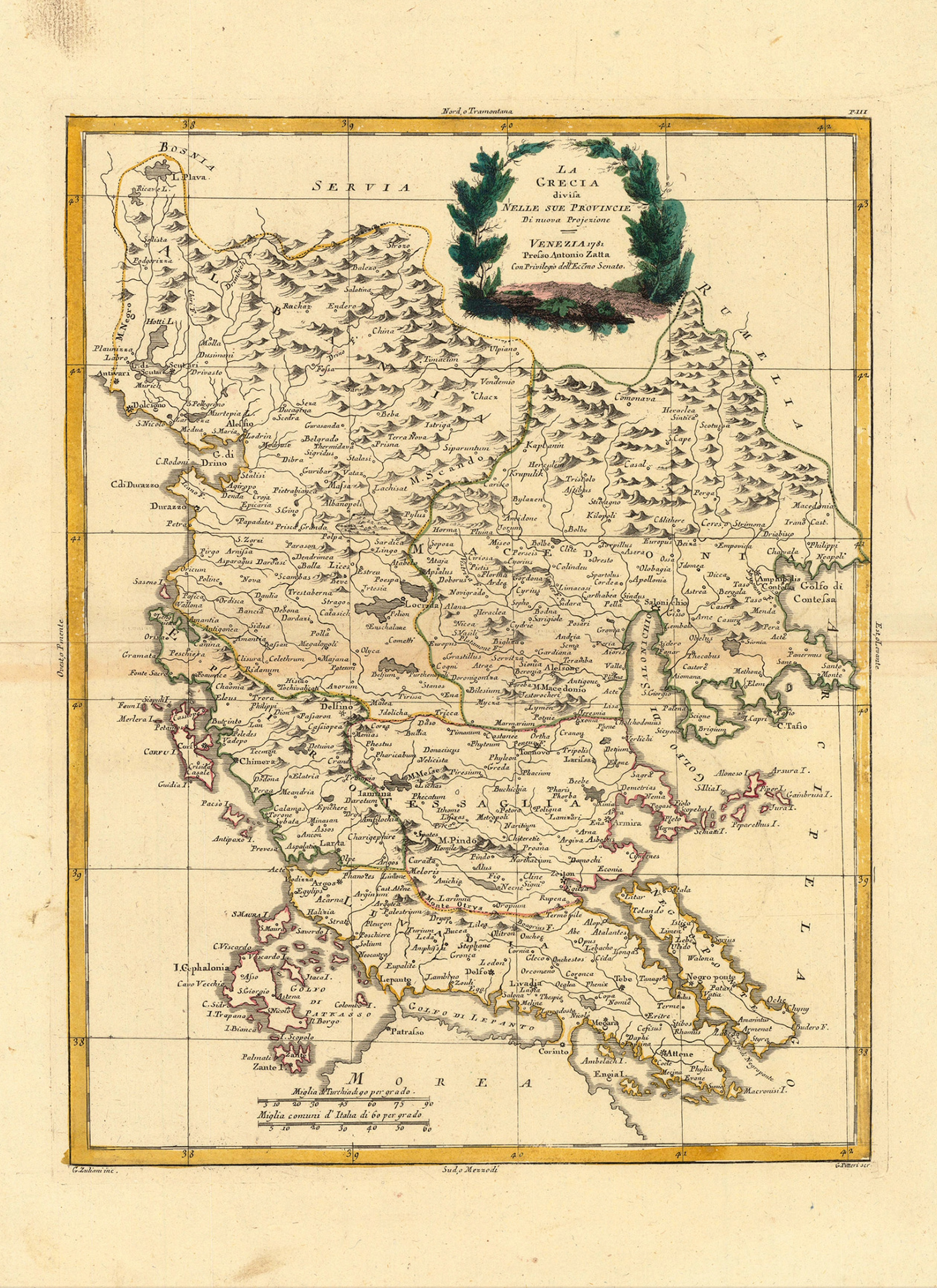
 La Grecia Divisa Nelle Sue Provincie

| * | Creator: Antonio Zatta |
| * | Publication Year: 1781 |
| * | Title Translation: Greece divided into its provinces |
| * | Publisher Location: Venice |
| * | Regions Depicted:Greece, Servia, Bosnia, parts of Albania |
| * | Political Context: Venetian Republic’s influence |
| * | Key Features: Detailed cartography, delineation of territories, cities, natural features (mountains, rivers) |
| * | Decorative Element: Foliage-decorated title cartouche |
| * | Scale: Indicated in Italian miles |
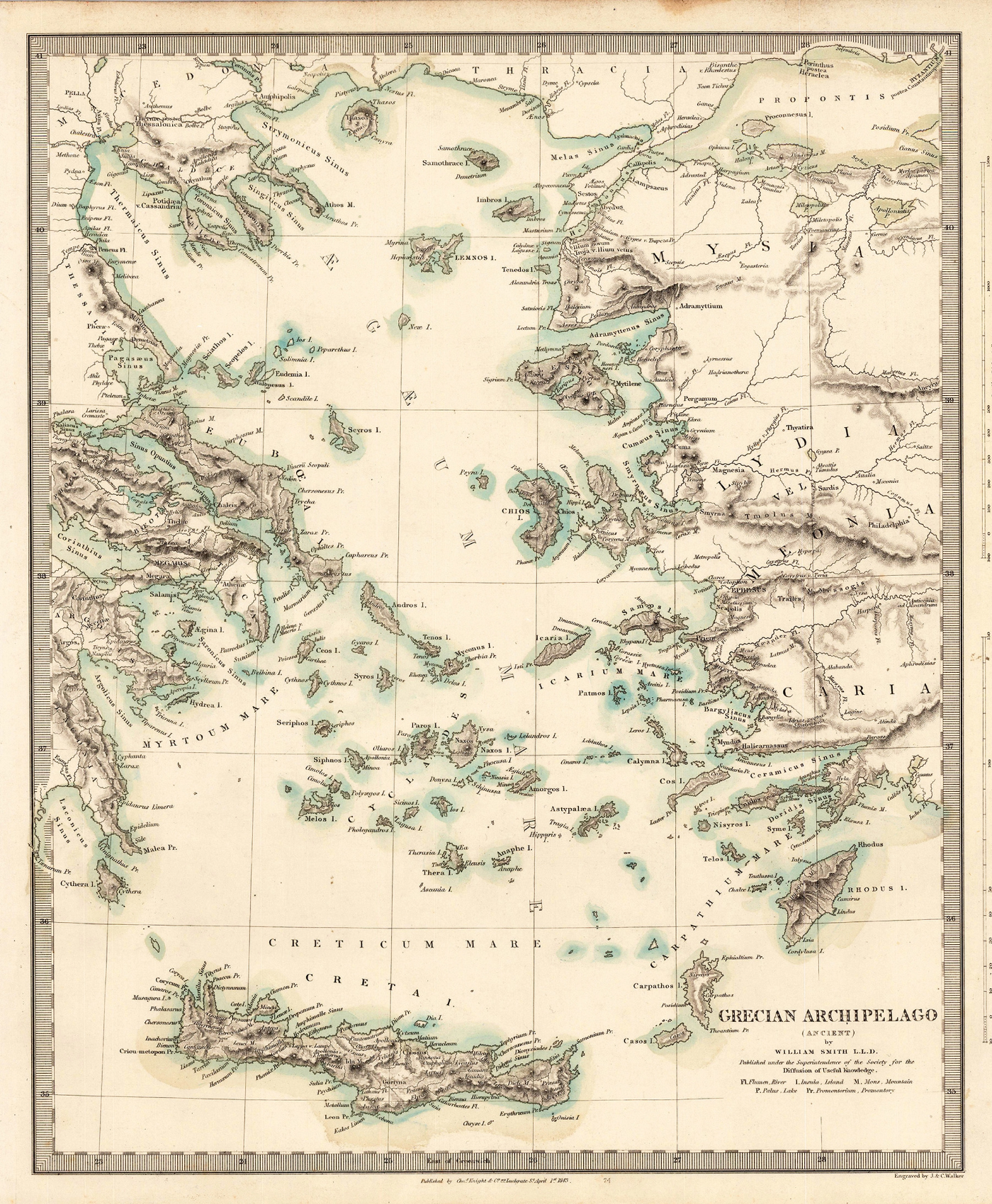
Grecian Archipelago (Ancient)

| * | Title: Grecian Archipelago (Ancient) |
| * | Attribution: WILLIAM SMITH LLD. (bottom right corner) |
| * | Time Period Focus: Ancient Greece |
| * | Publisher Location: Venice |
| * | Likely Creation Date: 19th Century (based on attribution) |
| * | Regions Depicted: Grecian Archipelago, surrounding islands, and coastlines |
| * | Bodies of Water Labeled: CRETICUM MARE (Cretan Sea), MYRTOUM MARE (Myrtoan Sea) |
| * | Features Shown: Islands, bodies of water, landmasses with elevation details |
| * | Potential Purpose: Educational or reference |
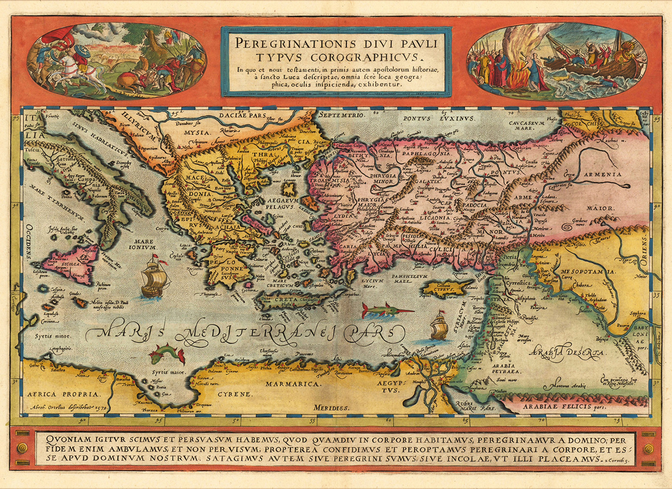
Peregrinationis Divi Pavli Typvs Corographicvs
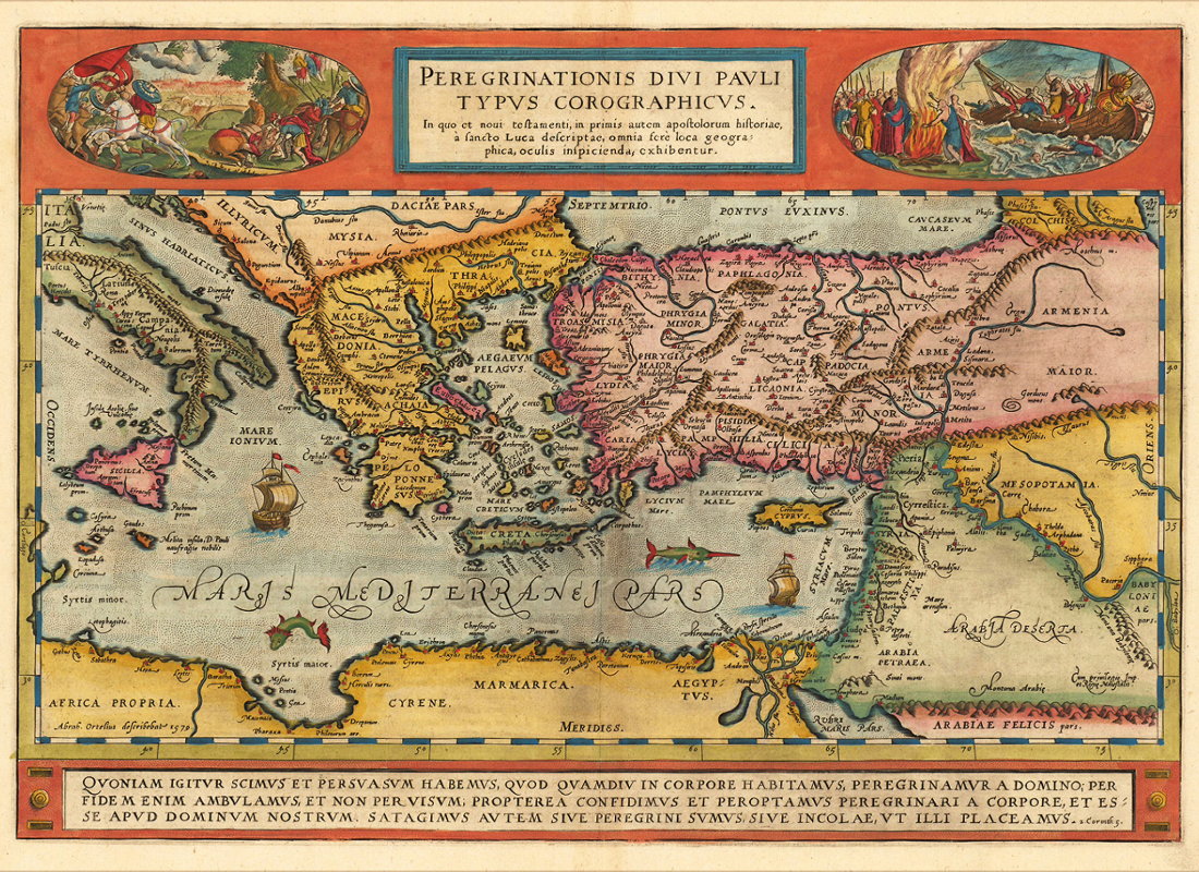
| Title: Grecian Archipelago (Ancient) | |
| Attribution: WILLIAM SMITH LLD. (bottom right corner) | |
| Time Period Focus: Ancient Greece | |
| Publisher Location: Venice | |
| Likely Creation Date: 1578 | |
| Regions Depicted: Grecian Archipelago, surrounding islands, and coastlines | |
| Bodies of Water Labeled: CRETICUM MARE (Cretan Sea), MYRTOUM MARE (Myrtoan Sea) | |
| Features Shown: Islands, bodies of water, landmasses with elevation details | |
| Potential Purpose: Educational or reference |
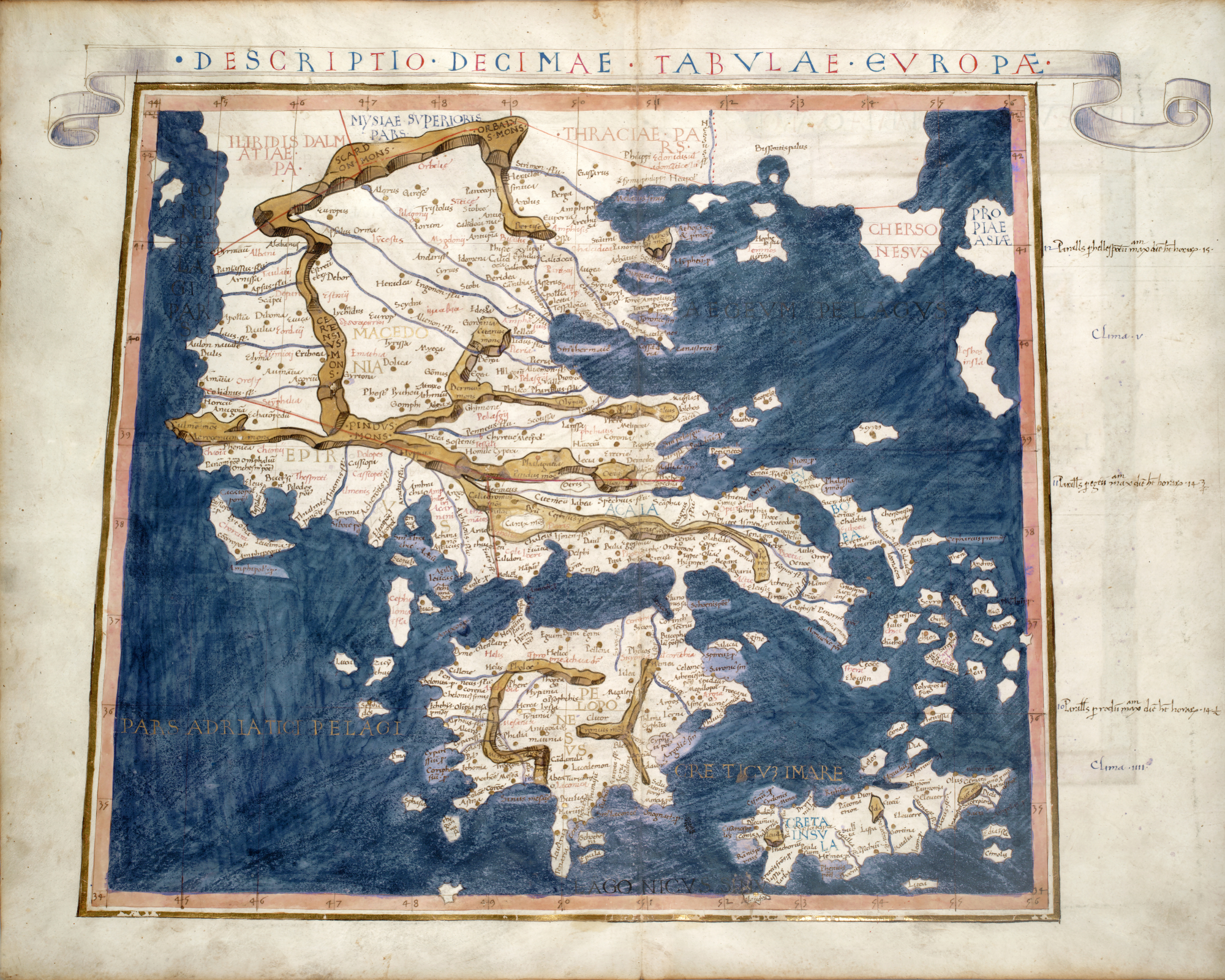
Claudius Ptolemy’s Ancient Greece Map (c. 150 CE, 1480 Edition)

| Original Creator: Claudius Ptolemy | |
| Original Creation Date: c. 150 CE | |
| Edition Shown: 1480 | |
| Work: Ptolemy’s “Geography” | |
| Key Innovation: Use of latitude and longitude lines | |
| Time Period Focus: Roman Era understanding of ancient Greece | |
| Regions Depicted: Greece, Thrace, Macedonia | |
| Significance: Represents ancient geographical knowledge and 15th-century cartographic reproduction. |
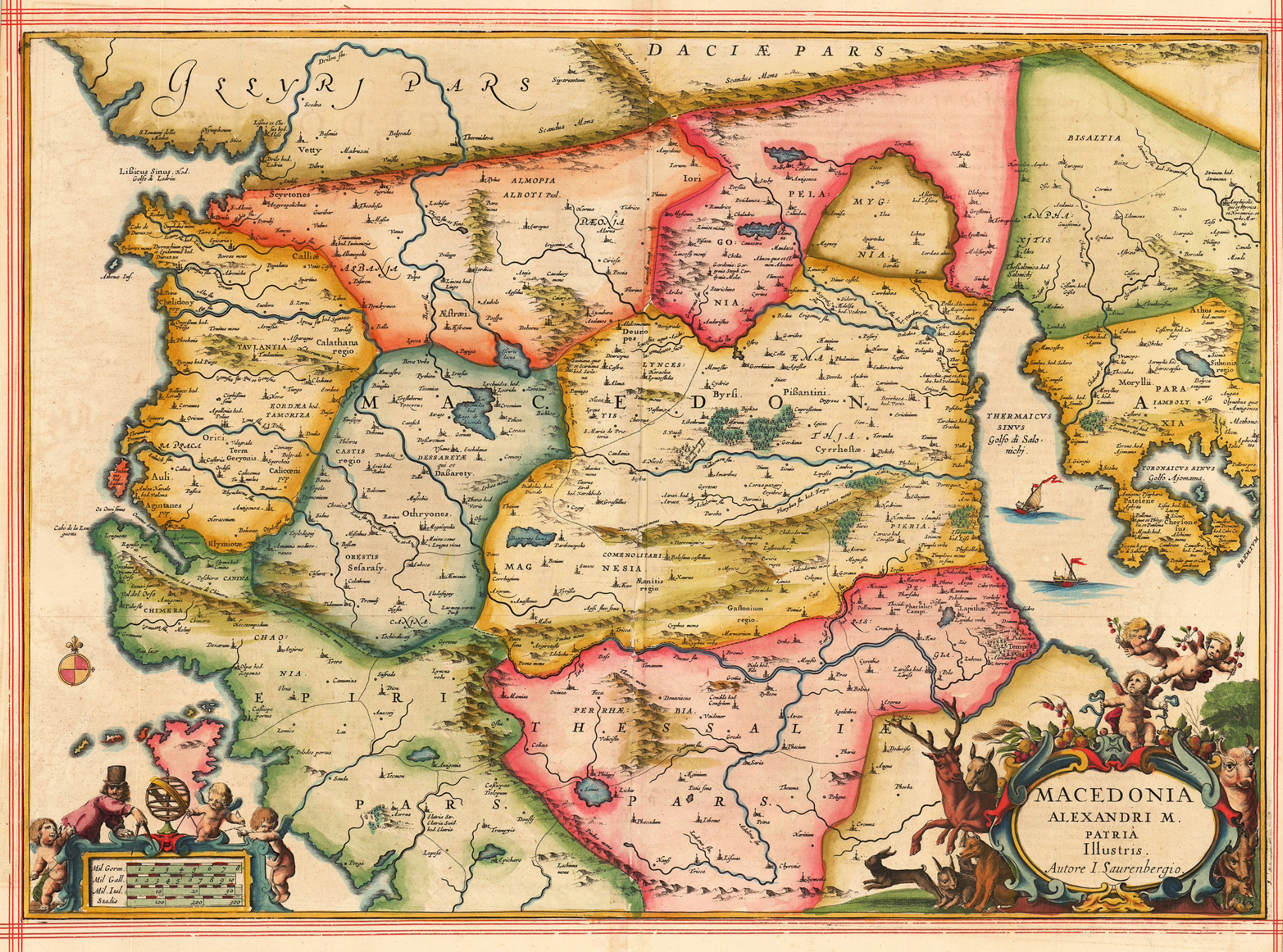
Macedonia Alexandri Magni Patria – Jansson’s 17th-Century Map of Alexander the Great’s Macedonia

| Title Translation: Macedonia, Fatherland of Alexander the Great | |
| Creator: Jan Jansson (based on publication) | |
| Engraver: Jodocus Hondius Jr. | |
| Attribution Note: “Autore I Saurenbergio” (author I. Saurenberg) | |
| Publication Year: 1654 (Jansson’s publication) | |
| Region Depicted: Macedonia | |
| Historical Focus: Time of Alexander the Great | |
| Orientation: West at the top | |
| Features: Terrain, rivers, settlements, regional divisions | |
| Decorative Elements: Cherubs, coat of arms, allegorical scene (lower right) |