Table of Contents: Ancient Mediterranean Map
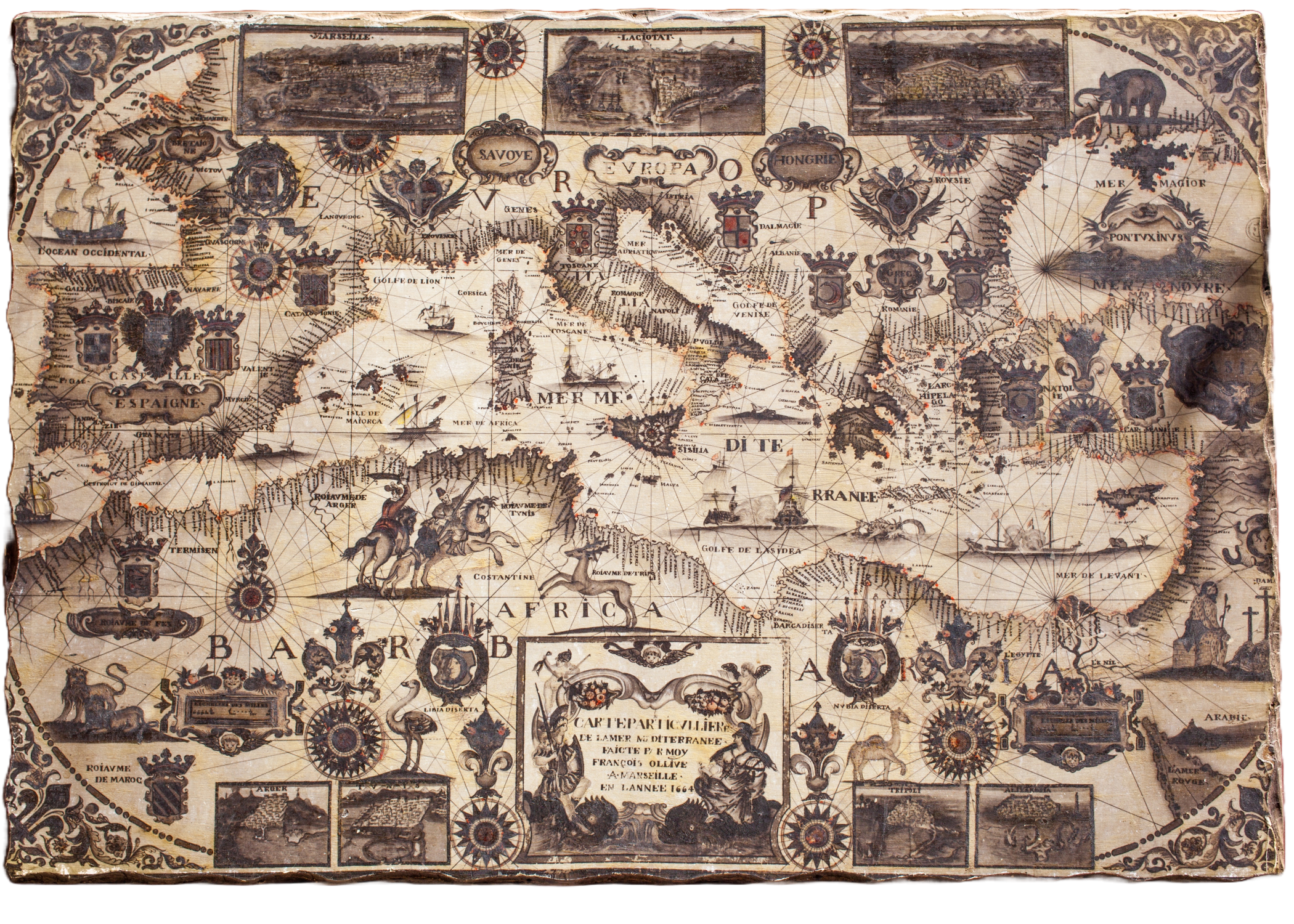
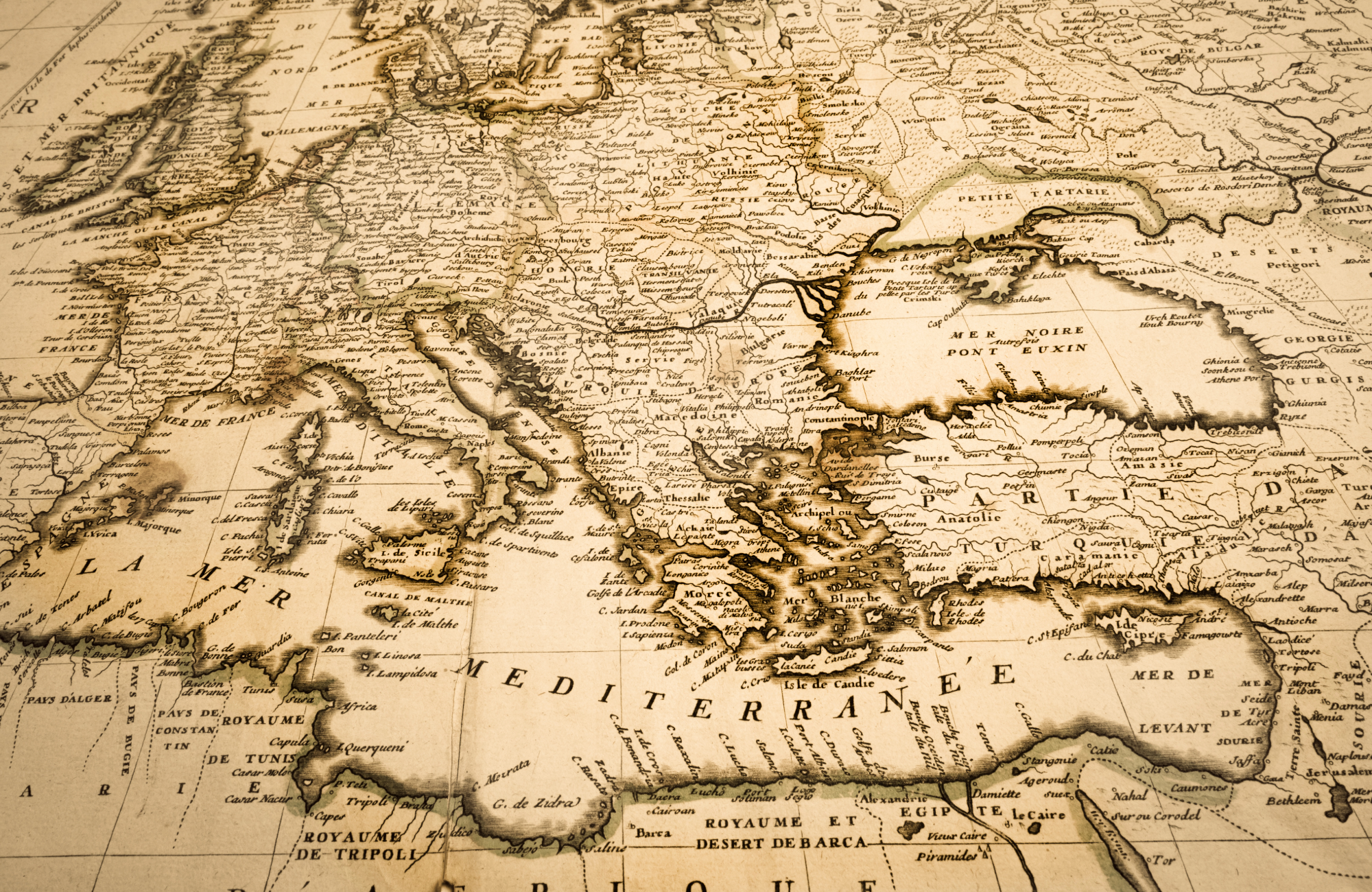
- Nouvelle carte de la mer Méditerranée – François Ollive (1664)
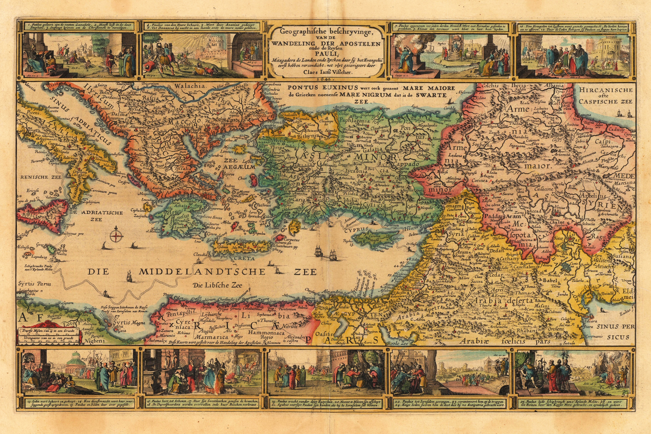
- Geographische beschrijvinge van de wandeling der apostelen Pauli – Claes Janszoon Visscher (c. early 17th Century)
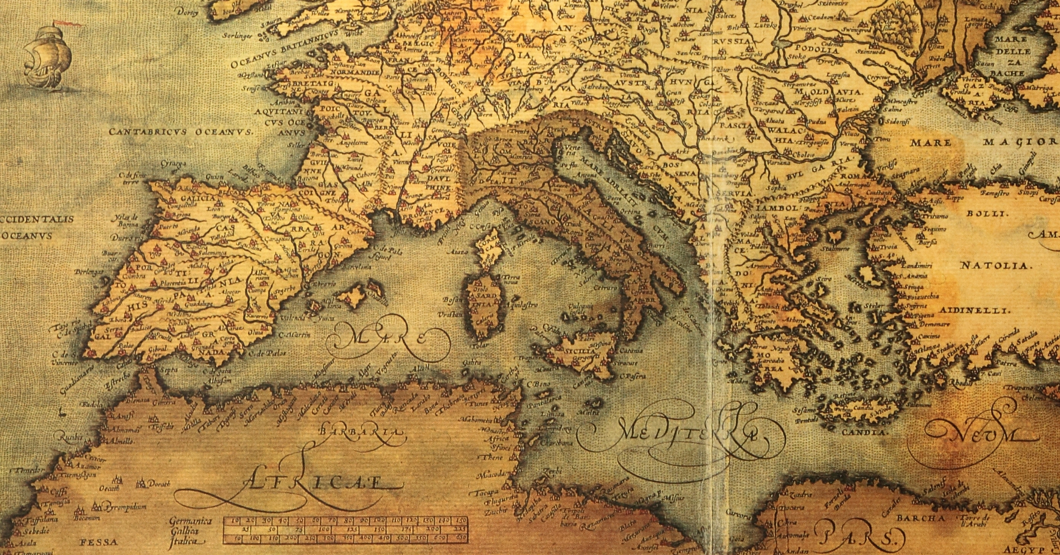
- Mediterranean Sea and Surrounding Regions – Likely Abraham Ortelius (c. late 16th Century)
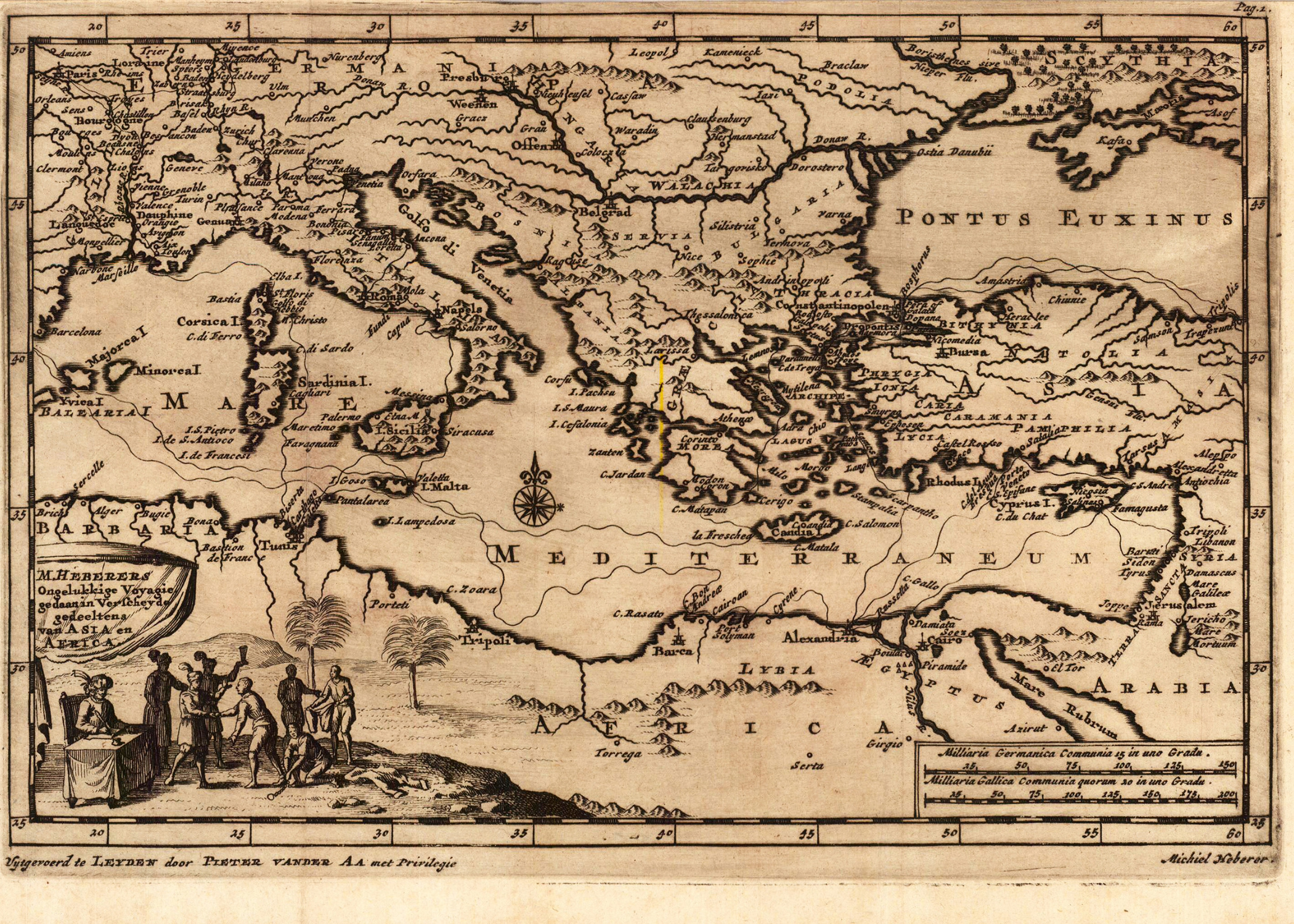
- Mediterranean Area – Pieter van der Aa, Engraved by Michiel Haberer (c. late 17th/early 18th Century)
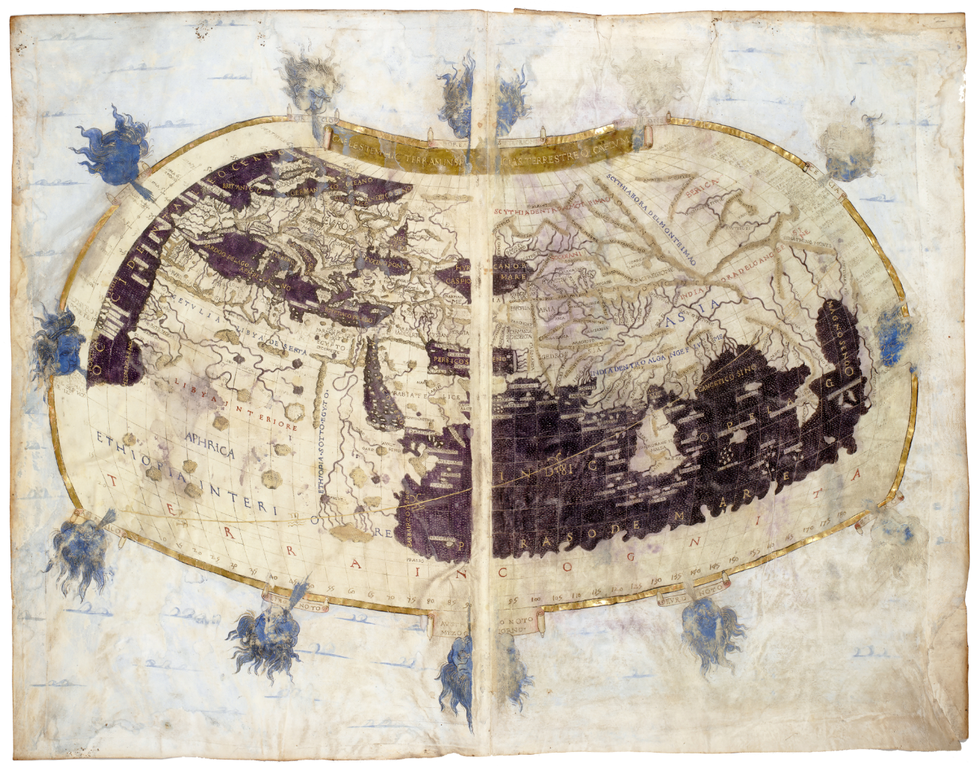
- Ptolemy’s World Map – 2nd Century AD (Greco-Roman)
This selection of Ancient Mediterranean maps illuminates the 17th-century Mediterranean, a pivotal era marked by increasing Northern European influence in trade and ongoing naval competition between powers like the Ottomans and various European states. Claes Janszoon Visscher’s early 17th-century map, depicting St. Paul’s journeys, reflects the enduring religious significance of the region amidst burgeoning global trade networks. Simultaneously, François Ollive’s ornate 1664 chart highlights the maritime importance of the Mediterranean, crucial for trade routes vulnerable to both state-sponsored navies and the rampant piracy of the era. With he later 17th-century map by Pieter van der Aa, engraved by Michiel Haberer, further underscores the region’s central role in European commerce and geopolitical strategies.
The potential inclusion of 16th or 17th-century maps in this grouping, possibly by Ortelius, would situate these depictions within a period where cartography flourished, fueled by Renaissance artistry and a growing demand for accurate geographical knowledge spurred by exploration and trade. These maps, with their detailed coastlines and Latinate nomenclature, would represent a blend of classical knowledge and contemporary understanding of a Mediterranean Sea increasingly contested by emerging European powers vying for maritime dominance and trade supremacy against the backdrop of established Ottoman influence.
 Nouvelle carte de la mer Méditerranée – François Ollive (1664)

| * | Creator: François Ollive |
| * | Publication Year: 1664 |
| * | Region Depicted: Mediterranean Sea and surrounding regions |
| * | Key Features: Detailed illustrations of coastal cities, ships, geographical features |
| * | Decorative Elements: Ornate cartouches, compass roses, depictions of mythical figures and animals (typical of the 17th century) |
Geographische beschrijvinge van de wandeling der apostelen Pauli – Claes Janszoon Visscher (c. early 17th Century)

| * | Creator: Claes Janszoon Visscher (Dutch cartographer and engraver) |
| * | Likely Publication Era: Early 17th Century |
| * | Region Depicted: Mediterranean region (focus on St. Paul’s travels) |
| * | Language: Dutch and Latin (place names) |
| * | Key Feature: Depiction of the travels of the Apostle Paul |
| * | Decorative Elements: Scenes depicting events from the Bible surrounding the map. |
Mediterranean Sea and Surrounding Regions – Likely Abraham Ortelius (c. late 16th Century)

| * | Likely Creator: Abraham Ortelius (Flemish cartographer and geographer) |
| * | Likely Publication Era: Late 16th Century (consistent with Ortelius’s active period and style) |
| * | Region Depicted: Mediterranean Sea and surrounding regions (Europe, North Africa, Middle East) |
| * | Stylistic Notes: Detailed coastlines, Latin place names, decorative cartouches (characteristic of Ortelius) |
| * | Textual Clues: Labels like “CANTABRICVS OCEANVS” and “AFRICAE” align with historical map conventions of the era. |
| * | Historical Significance: Oldest preserved cartographic depiction of the Holy Land |
| * | Historical Significance: Ortelius created the first modern atlas, “Theatrum Orbis Terrarum” (1570). |
Mediterranean Area – Pieter van der Aa, Engraved by Michiel Haberer (c. late 17th/early 18th Century)

| * | Creator (Publisher): Pieter van der Aa (Leiden, Netherlands) |
| * | Engraver: Michiel Haberer |
| * | Likely Publication Era: Late 17th or early 18th Century |
| * | Region Depicted: Mediterranean area (Italy, Greece, Turkey, North Africa) |
| * | Publisher Information: “Sayerwerd te Leyden door Pieter vander Aa met Privilegie” (Published in Leiden by Pieter van der Aa with Privilege) |
Ptolemy’s World Map – 2nd Century AD (Greco-Roman)
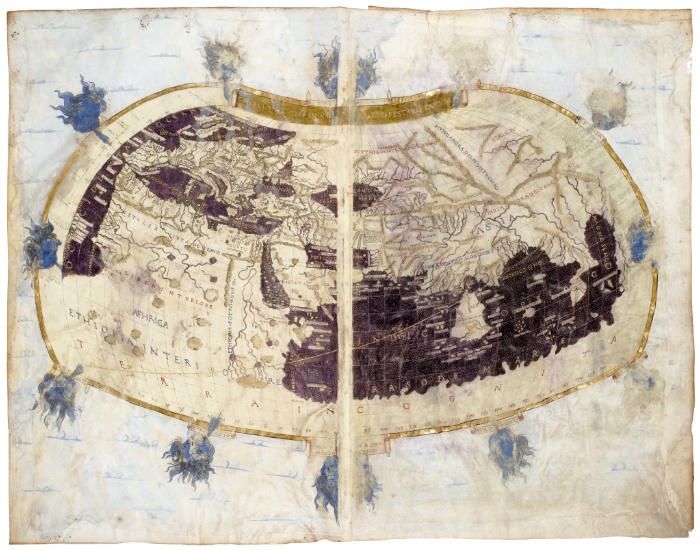
| * | Creator: Claudius Ptolemy (Greek mathematician, astronomer, geographer) |
| * | Publication Year: c. 150 AD (Geography) – this refers to the description; the map itself is a later reconstruction based on his text. |
| * | Region Depicted: The world as known to Greco-Roman societies (Europe, parts of Asia and Africa). |
| * | Key Features: Detailed city layout, landmarks, legend identifying sites |
| * | Historical Context: 2nd Century AD, Greco-Roman era, significant influence on subsequent cartography. |
| * | Key Contributions: Recording of longitudes and latitudes for ~8,000 locations, introduction of map projections (including conic). |
| * | Influence: Dominated cartography for over a thousand years. |
| * | Precursor: Builds upon earlier maps (e.g., Anaximander of Miletus). |