Table of Contents: Ancient Assyria Map
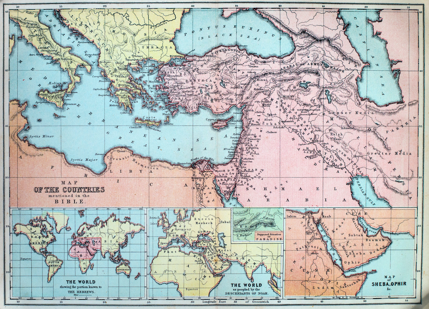
- Map of the Countries mentioned in the Bible – Chambers Brothers (1869)
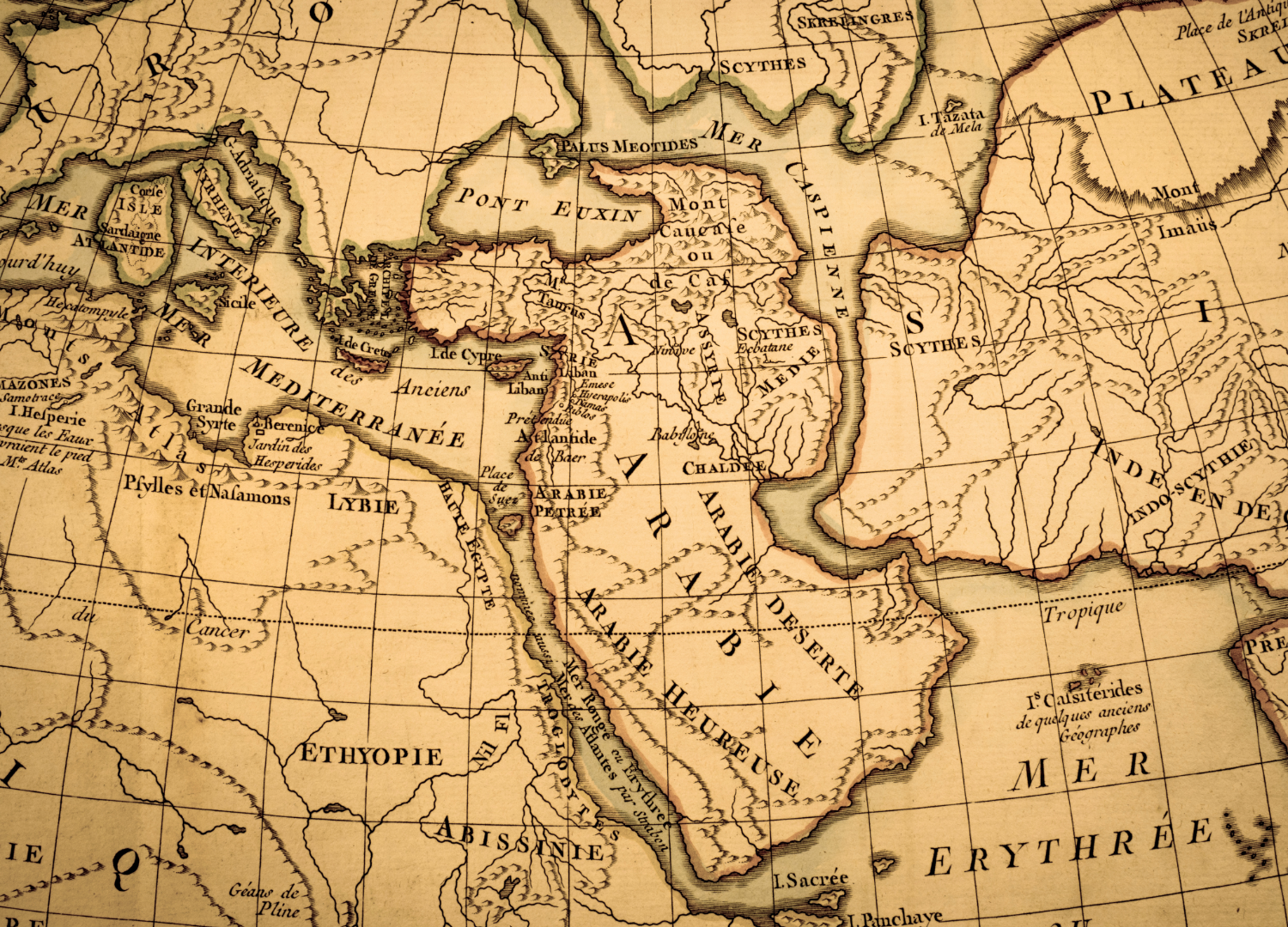
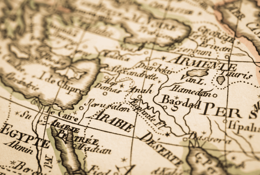
- Carte de l’Arabie – Anonymous (Possibly 18th century)
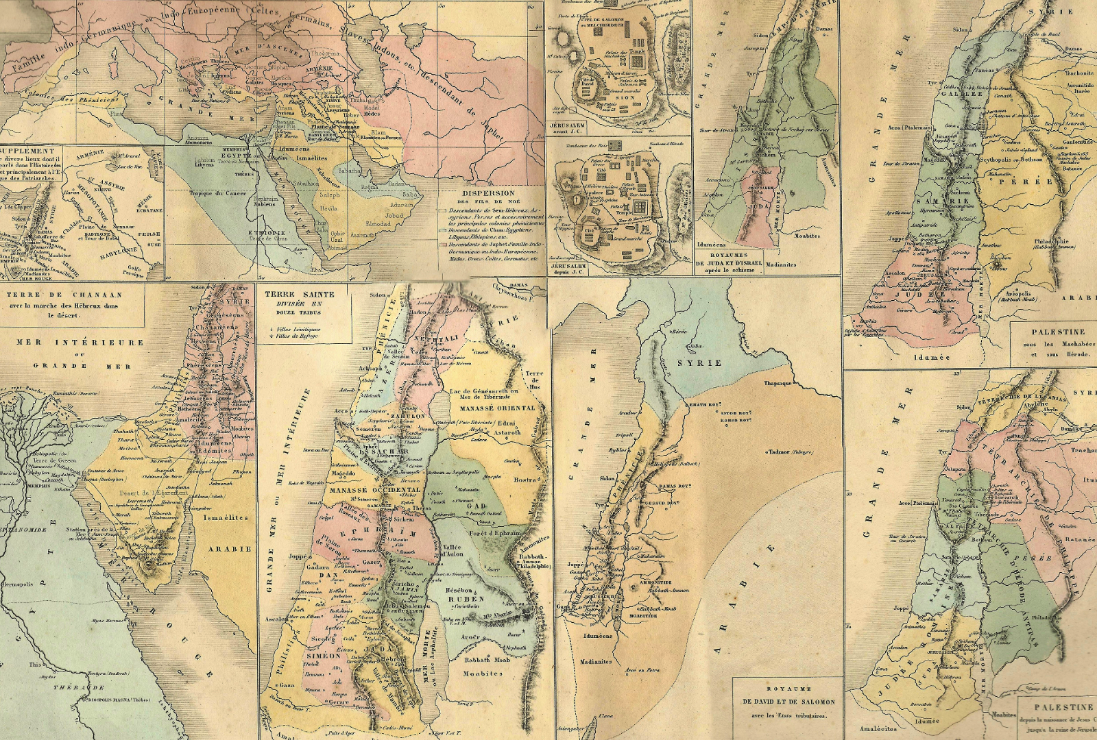
- Carte de la Terre Sainte – Drioux & Leroy (1869)
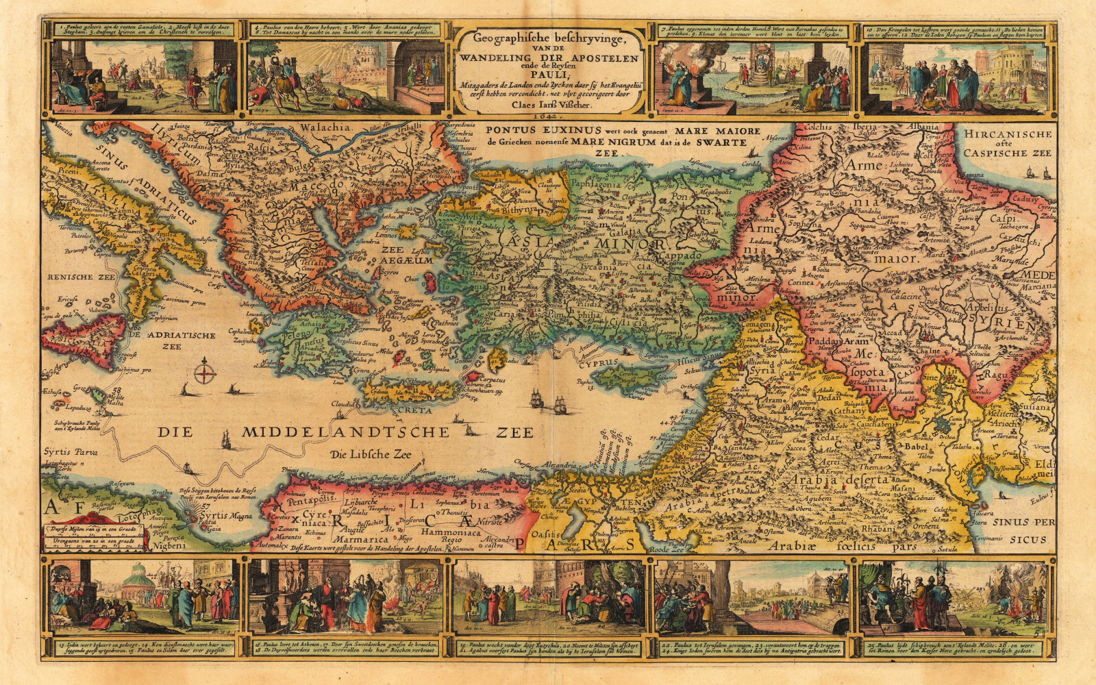
- Wandeling der Apostelen – Claes Jansz. Visscher (1642)
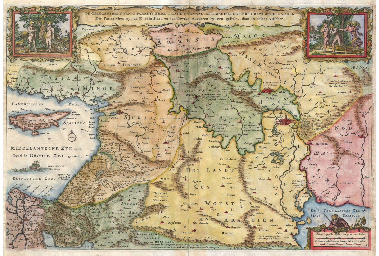
- De gelegentheyt van ‘t Paradijs ende ‘t Landt van Canaan – Nicolaes Visscher (1657)
The maps discussed here—spanning from 1642 to 1869—not only reflect European cartographic traditions but also inadvertently reveal the enduring legacy of ancient Near Eastern empires, particularly the Assyrian Empire, in shaping perceptions of sacred and political geography. For instance, Nicolaes Visscher’s 1657 map (De gelegentheyt van ‘t Paradijs) includes regions like Aramesia—a term rooted in the Assyrian-controlled Aramean kingdoms (9th–7th centuries BCE)—demonstrating how biblical cartography preserved Assyrian-era territorial divisions. Similarly, the anonymous 18th-century Arabian map labels the “MER ERYTHREE” (Erythraean Sea), a term first used in Assyrian trade records to denote the Red Sea and Persian Gulf.
The Chambers’ 1869 Holy Land map, while Victorian in execution, still demarcates Assyria’s historical sphere of influence, echoing imperial boundaries from the Neo-Assyrian period (911–609 BCE). Even Visscher’s 1642 Apostle Paul map indirectly engages with Assyrian history, as Paul’s travels through Syria and Anatolia traversed lands once ruled by Assyrian governors. These maps, though created millennia after Assyria’s fall, perpetuate its geographic frameworks, proving how deeply Assyrian administrative borders, trade routes, and terminology became embedded in later Greco-Roman, Islamic, and European cartography. Far from neutral, these works are palimpsests of imperial memory, where 17th-century Dutch engravers and 19th-century French scholars unknowingly replicated the spatial logic of an empire that dominated the Near East three thousand years prior.
 Map of the Countries mentioned in the Bible – Chambers Brothers (1869)

| * | Creator: William and Robert Chambers (publisher) |
| * | Publication Year: 1869 |
| * | Region Depicted: Biblical lands (Middle East, Mediterranean Europe, North Africa) |
| * | Key Features: Labeled towns, rivers, mountain ranges; insets of the ancient Hebrew world and Noah’s descendants |
| * | Decorative Elements: Hand-colored regions, ornate typography |
Carte de l’Arabie – Anonymous (Possibly 18th century)

| * | Attribution: Unknown (likely French cartographer) |
| * | Estimated Period: 18th century |
| * | Region Depicted: Arabian Peninsula and adjacent lands |
| * | Key Features: Labels in French (e.g., “ARABIE PETREE,” “ARABIE DESERTE,” “ARABIE HEUREUSE“) Notable geographic terms: “MEDITERRANEE,” “MER ERYTHREE“ Stylistic hallmarks of 18th-century European cartography |
| * | Decorative Elements: Typical of the period (e.g., ornate lettering, possible cartouches or compass roses – if visible). |
Carte de la Terre Sainte – Drioux & Leroy (1869)

| * | Creators: Mm. Drioux et Ch. Leroy |
| * | Publication Year: 1869 |
| * | Publisher: Librairie C. Stock, Paris |
| * | Region Depicted: Holy Land (Palestine, Israel and surrounding biblical territories) |
| * | Key Features: -Historical and geographical demarcations of biblical lands -Labels in French reflecting 19th-century Catholic scholarship -Likely includes sacred sites, ancient tribes and pilgrimage routes |
| * | Decorative Elements: Characteristic of 19th-century French religious cartography (e.g., ornate borders, possible vignettes of holy sites) |
Wandeling der Apostelen – Claes Jansz. Visscher (1642)

| * | Creator: Claes Janszoon Visscher |
| * | Year: 1642 |
| * | Region Depicted: Mediterranean Basin (Europe, Asia Minor, North Africa) including Black Sea (“Pontus Euxinus”/”Swarte Zee”) Assyria Map Depictions. |
| * | Region Depicted: Mediterranean area (Italy, Greece, Turkey, North Africa) |
| * | Primary Subject: Apostolic journeys of Paul |
| Key Features: -Annotated routes of Pauline voyages -Dual Latin/Dutch nomenclature (e.g., “Mare Nigrum”/”Swarte Zee”) -Topographical details of biblical cities and sea routes | |
| Decorative Elements: -Narrative border vignettes. Depicting Pauline episodes -Baroque cartouches and sailing vessels -Allegorical figures typical of Dutch Golden Age cartography |
De gelegentheyt van ‘t Paradijs ende ‘t Landt van Canaan – Nicolaes Visscher (1657)

| * | Creator: Nicolaes Visscher I (1618-1679) |
| * | Year: 1657 |
| * | Publisher: Likely published in Amsterdam |
| * | Region Depicted: Biblical Holy Land with conceptual Paradise |
| * | Key Features: -Composite biblical geography merging Genesis and Exodus narratives -Labeled regions: Aramesia, Syria, Arabia, Canaan -Four rivers of Paradise (Pishon, Gihon, Tigris, Euphrates) -Dutch place names with Latin influences |
| * | Decorative Elements: -Elaborate Baroque cartouche (likely featuring Adam and Eve) -Possibly includes vignettes of biblical scenes -Stylized topography with mountain ranges and river systems |
| * | Influence: Dominated cartography for over a thousand years. |
| * | Precursor: Builds upon earlier maps (e.g., Anaximander of Miletus). |