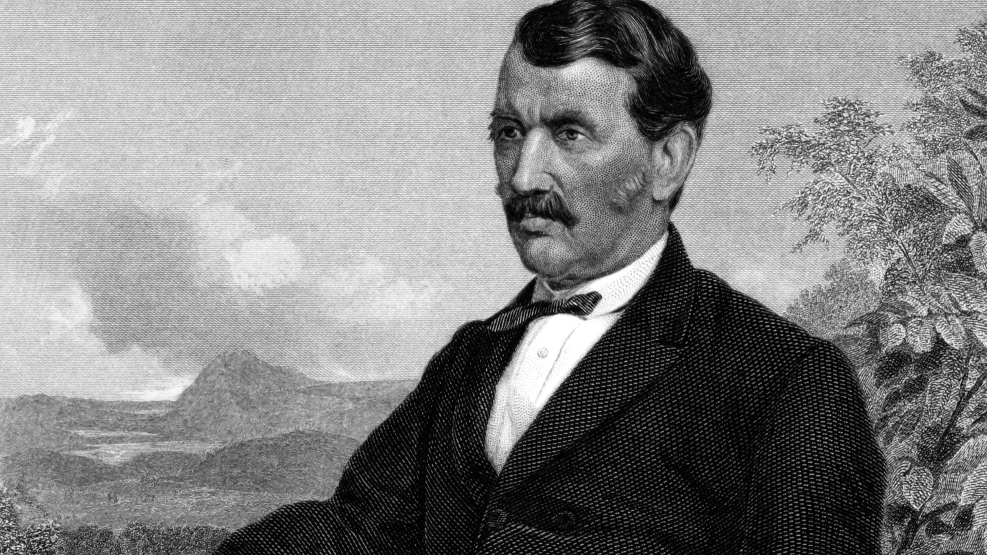
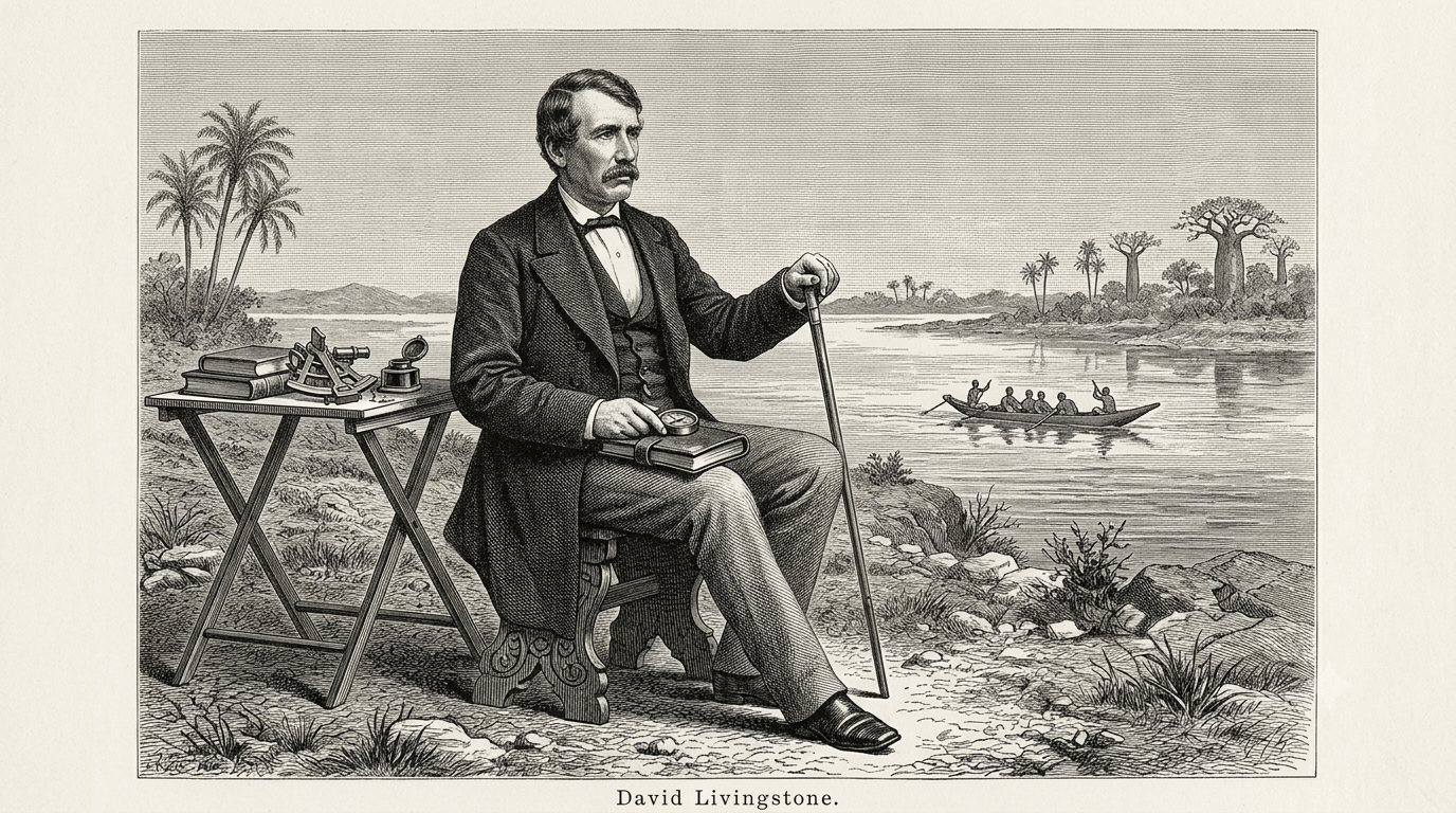
DAVID LIVINGSTONE (BRITISH EMPIRE / EXPLORATION ERA)
C. 1813 – 1873 AD
Table of Contents: David Livingstone

David Livingstone. The patronymic surname reflects a complex anglicization of the Gaelic MacLeay lineage from the southern Hebrides, anchoring his identity in a displaced Scottish working-class stratum that was forced into the industrial factory systems of Lanarkshire.

Blantyre, South Lanarkshire, Scotland (United Kingdom). This urbanized industrial hub on the River Clyde operated as a central node for processing global imperial commodities, utilizing intense mechanized labor pools that directly funded Britain’s commercial expansion. [1]

1841 – 1873 AD. His active years involved extensive journeys across south-central Africa to chart major hydrological routes and expand colonial networks. These missions ultimately resulted in his exhaustion, logistical failures, and fatal obsession with the Nile headwaters. [1]

London Missionary Society, Royal Geographical Society, British Foreign Office, and various Swahili-Arab merchant guilds. Although he publicly championed Western religious institutions, his field survival depended entirely upon shifting tactical allegiances with local African chiefdoms and Afro-Arab traders. [1, 2]

The Agent of Imperial Penetration. Colonial administrators and critics like Lord Clarendon designated him an official representative of British interests, marking a calculated transition away from uncoordinated private exploration toward state-sponsored territorial reconnaissance.

Livingstone established the geographic templates that directly facilitated the subsequent European partition of the African interior. His published journals, charts, and lectures converted complex indigenous landscapes into structured operational maps for Western corporate extraction.

Discovery of Lake Ngami, Victoria Falls exploration, trans-continental journey to Luanda, Zambezi expedition, final search for the Nile.

He documented the horrors of the East African slave trade with visceral detail, using his influence to defend indigenous liberty.

| His public reputation underwent intense scrutiny by twentieth-century post-colonial historians who exposed his severe administrative flaws and deep complicity in British expansion. |
“I will place no value on anything I have or may possess, except in relation to the kingdom of Christ.”
– David Livingstone
Overview: David Livingstone
David Livingstone operated as a central figure in the ideological and physical penetration of the African interior during the mid-nineteenth century. Emerging from the harsh environment of a Scottish industrial cotton mill, he utilized theological training and medical qualifications to secure a platform within the London Missionary Society.
However, he quickly abandoned localized proselytization in favor of continuous geographical movement, transforming himself into a highly visible agent of British imperial interests. His public persona was carefully constructed around the concepts of humanitarian intervention and scientific progress. Yet, his expeditions actively disrupted existing regional balances by recording local resources and evaluating navigable rivers. By channeling his observations into the institutional networks of Victorian London, he provided the crucial cartographic intelligence required to undermine indigenous sovereignty. Consequently, his career illustrates the direct connection between philanthropic rhetoric and territorial expansion. [1, 2, 3, 4, 5]
His field research focused heavily on tracing the major river networks of the Zambezi, Shire, and Lualaba rivers. He executed these grueling journeys by relying on the labor, protection, and geographical knowledge of diverse African companions, whom he frequently failed to credit adequately in his official publications. His reliance on Swahili-Arab trading networks further complicated his public stance against the regional slave trade, revealing the deep structural contradictions of his position.
While he claimed to bring objective Western science to a blank space on the map, his journals actually documented highly sophisticated, pre-existing indigenous political landscapes. His systematic failure to locate a navigable highway into the interior during the state-sponsored Zambezi Expedition exposed the limitations of his romantic geographic theories. Ultimately, his obsessive, uncoordinated efforts to locate the Nile headwaters resulted in absolute logistical isolation, showcasing the tragic hubris of the mid-Victorian exploratory enterprise. [1, 2, 3, 4, 5]
Did you know? David Livingstone

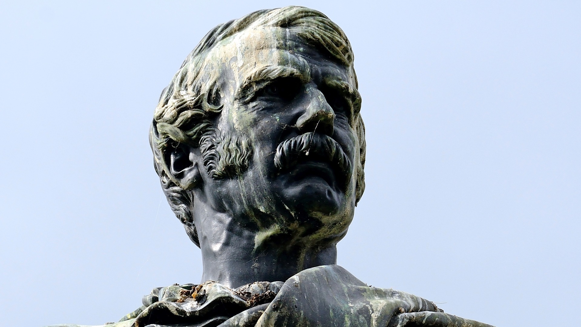
A life-sized marble statue in the Royal Geographical Society portrays him in his explorer’s gear. It features a Bible and a sextant, serving as a permanent memorial to his role as a scientific investigator.

Critics long dismissed his reports on the internal slave trade as exaggerated propaganda intended to justify expansion. Recent spectral analysis of his faded field diaries has confirmed his granular counts and testimonies, proving his record was accurate.

| Livingstone functioned as a traveling scientific researcher. He performed complex medical procedures for local leaders to secure passage and protection across hostile, disease-prone environments. |
Timeline of David Livingstone
The chronological timeline of David Livingstone tracks his evolution from an obscure factory worker into a premier, highly contested instrument of British imperial cartography. This introductory paragraph outlines the detailed data structure below, which balances his highly precise personal actions against the massive shifting realities of nineteenth-century global market networks, proving that geographic measurements served directly as tools of economic expansion
Timeline Chronology
| YEAR | EVENT | DESCRIPTION |
|---|---|---|
| 1813 AD | Industrial Birth | Born into a working-class family experiencing extreme poverty within the cotton mill housing blocks of Blantyre, Scotland. |
| 1823 AD | Labor Extraction | Works long hours under strict industrial discipline as a piecer, using nominal wages to purchase classical books. |
| 1836 AD | Institutional Mobility | Attends university classes in Glasgow, leveraging medical training to escape the permanent traps of factory labor. |
| 1838 AD | Imperial Recruitment | Submits his credentials to the London Missionary Society, aligning his personal ambitions with global religious expansion. |
| 1840 AD | Ideological Ordination | Receives official medical certification and religious ordination just as Britain expands its commercial influence in southern Africa. |
| 1841 AD | Colonial Arrival | Reaches Cape Town and moves inland to Kuruman, immediately challenging established, sedentary missionary methods. |
| 1843 AD | Inland Advance | Moves deep into Bechuana territory, establishing remote stations that serve as operational springboards for northern transit. |
| 1845 AD | Mabotsa Settlement | Settles at Mabotsa, where an attack by a lion permanently impairs his left arm and reshapes his public image. |
| 1849 AD | Kalahari Reconnaissance | Crosses the Kalahari Desert alongside wealthy British patrons, capturing the attention of the Royal Geographical Society. |
| 1852 AD | Logistical Reorientation | Sends his family back to Britain, freeing himself from domestic ties to pursue full-time geographical reconnaissance. |
| 1853 AD | Barotseland Alliance | Secures a political alliance with Sekeletu, King of the Makololo, obtaining essential porters for an Atlantic route. |
| 1854 AD | Luanda Transit | Reaches the Angolan coast, refusing extraction by a British ship to maintain his commitments to his African porters. |
| 1855 AD | Imperial Naming | Observes the massive Mosi-oa-Tunya waterfalls, immediately renaming them Victoria Falls to secure royal patronage in London. |
| 1856 AD | Transcontinental Exit | Arrives at the Indian Ocean port of Quelimane, completing a major transcontinental traverse that exposed the interior. |
| 1857 AD | Capitalist Synthesis | Publishes his highly influential travel memoirs, generating massive capital and advocating for British commercial colonization. |
| 1858 AD | Consular Elevation | Resigns from his missionary society to accept a government commission as Consul for the Zambezi Expedition. |
| 1862 AD | Logistical Disaster | Suffers the loss of his wife, Mary, and faces intense mutiny from British scientists due to his erratic leadership. |
| 1864 AD | Official Recall | Receives a formal recall notice from the Foreign Office after his expedition fails to find a navigable river. |
| 1866 AD | Nile Obsession | Launches a final, poorly equipped journey from Zanzibar, driven by an obsession to find the Nile sources. |
| 1873 AD | Fatal Collapse | Succumbs to internal infections in the Chitambo wetlands, initiating a complex process of posthumous myth-making. |
Legacy of David Livingstone
David Livingstone left an indelible mark on the world by transforming the methods of geographical reconnaissance into a highly coordinated prelude to European colonization. His conceptualization of global expansion successfully linked humanitarian arguments with corporate extraction, providing the moral justification that Western powers required to launch the Scramble for Africa. By systematically mapping the central African interior, he transformed fluid indigenous territories into concrete, geometric assets that could be claimed, traded, and divided at European diplomatic tables. His published volumes became standard manuals for subsequent military and commercial incursions, directly guiding the logistics of concessionary companies. Through his efforts, exploration ceased to be a series of isolated adventures, turning instead into an empirical framework for imperial absorption. [1, 2, 3]
His work directly influenced subsequent generations of colonial administrators, corporate entities, and military figures who used his cartographic baselines to establish formal borders. He taught Western institutions to view the African interior through an economic lens, using detailed resource surveys to stimulate investment in railways and steamship lines. By framing British expansion as an absolute moral duty to eliminate local slave networks, his writings created a powerful rhetorical shield for subsequent imperial violence. Modern political boundaries in central and southern Africa still reflect the riverine routes and station points that he calculated with his instruments. Ultimately, Livingstone converted the practice of travel into an apparatus of statecraft, ensuring that his geographical output would serve as a structural blueprint for the total reorganization of the continent. [1]
Examples:
| Cartographic Erasure | Replacing ancient, highly functional indigenous names with Western monarchical designations to assert symbolic imperial ownership over geographical features. |
| Imperial Synthesis | Merging the distinct objectives of corporate trade, religious conversion, and state diplomacy into a single ideological doctrine. |
| Sextant Triangulation | Utilizing precise astronomical readings to anchor open terrain onto European coordinate sheets, preparing land for future concessions. |
| Vector Geography | Mapping the exact boundaries of the tsetse fly and malaria zones to determine viable routes for European draft animals. |
| Phonetic Standardization | Altering diverse Bantu oral dialects into standardized European alphabets, creating early colonial administrative vocabularies. |
| Consular Authority | Leveraging official state diplomatic status to bypass traditional tribute demands from independent indigenous leaders. |
| Hydrological Delusion | The obsessive, erroneous belief that a single central African watershed could explain the origins of the Nile, Congo, and Zambezi rivers. |
| Collaborative Suppression | Omitting or minimizing the sophisticated geographical expertise of local African guides within official imperial publication channels. |
| Rhetorical Abolitionism | Using graphic accounts of local slave trading to generate public support in London for military intervention. |
| Steamship Logistics | Introducing iron-hulled, steam-powered vessels into interior river systems to test lines for military and economic transport. |
| Resource Inventorying | Meticulously identifying outcroppings of coal, iron, and wild rubber to stimulate interest among British corporate combines. |
| Climatic Profiling | Collecting long-term temperature data to identify elevated, disease-free zones suitable for white agricultural settlement. |
| Oral History Manipulation | Interpreting local migration traditions selectively to justify European settlement patterns and downplay existing land claims. |
| Botanical Commercialization | Collecting unknown plant samples to evaluate their economic utility within the global networks of Kew Gardens. |
| Corporate Cartography | Converting individual travel itineraries into official state maps used by the British Foreign Office during boundary disputes. |
Additional Achievements of David Livingstone
Evaluating the foundational methodology of David Livingstone reveals an analytical mindset that systematically aligned geographical recording with the technical requirements of the Victorian state. He approached the African terrain with a distinct empirical focus, recognizing that the long-term success of British trade required the location of natural transportation corridors. By utilizing advanced astronomical instruments in difficult field conditions, he rejected the speculative maps of earlier decades. His analytical framework prioritized the recording of physical metrics, river depths, and agricultural potential, treating the landscape as an economic asset awaiting development. This methodology allowed him to establish a network of fixed coordinates across central Africa, giving Western institutions a reliable grid for planning systemic interventions.
The strategic execution of his research involved complex operational logistics, extreme physical endurance, and a highly inconsistent management style that frequently cracked under pressure. Livingstone covered immense distances across fragile ecosystems, navigating shifting political landscapes, marshy terrain, and hostile economic zones. He managed mixed teams of porters and guards, though his absolute inability to cooperate with other European specialists resulted in the breakdown of his larger command structures. His work disrupted existing geographical paradigms by disproving the theory that the African interior was a barren desert, showing instead that it was a well-watered plateau. This comprehensive data collection projected a lasting influence across decades, forcing European governments to view the continent as a vital arena for competitive imperial investment. [1, 2]
Examples:
| Lake Ngami | First European verification of the lake in 1849 via desert navigation. |
| Trans-Continental | Completed the first trans-continental traverse of Africa (1852–1856). |
| Victoria Falls | Documented and renamed the world’s largest waterfall complex in 1855. |
| Zambezi Mapping | Conducted the first systematic survey of the Zambezi River’s navigability (1858). |
| Anti-Slavery Data | Compiled the most comprehensive field data on the East African slave trade. |
| Medical Field Notes | Documented the efficacy of quinine in treating malaria during expeditionary travel. |
| Geographic Synthesis | Mapped over 1,000 miles of previously unknown central African territory. |
| Linguistic Records | Created extensive vocabularies for Tswana and other indigenous African languages. |
| Spectral Recovery | Recovered over 3,500 manuscript pages via modern spectral imaging techniques. |
| Hydrological Charts | Produced accurate charts of the Shire River and Lake Malawi basins. |
| Exploration Log | Maintained an unbroken 30-year journal of scientific and social observations. |
| Depot Protocols | Developed specific logistical methods for supply maintenance in extreme terrain. |
| Imperial Diplomacy | Established long-term communication channels between the British crown and local chiefs. |
| Disease Tracking | Correlated swamp environments with the prevalence of specific tropical fever cycles. |
| Flora/Fauna Surveys | Catalogued hundreds of unknown plant and animal species for European societies. |
| Cartographic Precision | Established standard protocols for mapping inland routes using portable sextants. |
| Social Mapping | Documented the hierarchical power structures of the Kololo and Kazembe kingdoms. |
| Navigation Standards | Set the standard for Victorian-era inland navigation using solar and stellar fixes. |
| Public Advocacy | Shifted British political policy through his vivid, empirical accounts of slavery. |
| Institutional Legacy | Founded the structural basis for the Universities Mission to Central Africa. |

References and Citations
- Livingstone, D. (1857). Missionary travels and researches in South Africa. John Murray. Read it on Internet Archive or access a DOI record on Crossref.
- Livingstone, D., & Livingstone, C. (1865). Narrative of an expedition to the Zambesi and its tributaries. John Murray. Access via Google Books. [1, 2]
- Blaikie, W. G. (1880). The personal life of David Livingstone. John Murray. (Read the contemporary review in Nature).
- Stanley, H. M. (1872). How I found Livingstone: Travels, adventures, and discoveries in Central Africa. Sampson Low Publishing. [1, 2]
- Modern Biographies & Studies
- 5. Seaver, G. (1957). David Livingstone: His life and letters. Harper & Brothers.
- 6. Gelfand, M. (1957). Livingstone the doctor, his life and travels: A study in medical history. Blackwell Publishing Ltd. [2]. Access the work via Wellcome Collection.
- 7. Jeal, T. (1973). Livingstone. Heinemann Publishers. (For a revised and expanded 2013 edition, visit Yale University Press).
- 8. Cannizzo, J. (1996). Doctor Livingstone, I presume? Missionary and explorer. National Museums of Scotland. Check their official site at National Museums Scotland.
- 9. Ross, A. C. (2002). David Livingstone: Mission and empire. Hambledon Press [1]. Purchase or view details on Bloomsbury.
- 10. Dritsas, L. (2010). Zambesi: David Livingstone and expeditionary science in Africa. I. B. Tauris & Co Ltd [1]. Preview the book on Bloomsbury.
- 11. Worden, N. (2013). Livingstone’s legacy: Essays on the bicentenary of David Livingstone. National Museums Scotland Limited [8].
- 12. Wisnicki, A. (2019). Fieldwork of empire, 1840–1900: Intercultural dynamics in the production of British expeditionary literature. Routledge. [1, 2, 3, 4, 5]
- Digital Editions & Bibliographic Databases
- 13. Wisnicki, A. S. (2017). Livingstone online: A multispectral critical edition. University of Maryland Libraries [2]. Explore the archives directly at Livingstone Online. [1, 2]