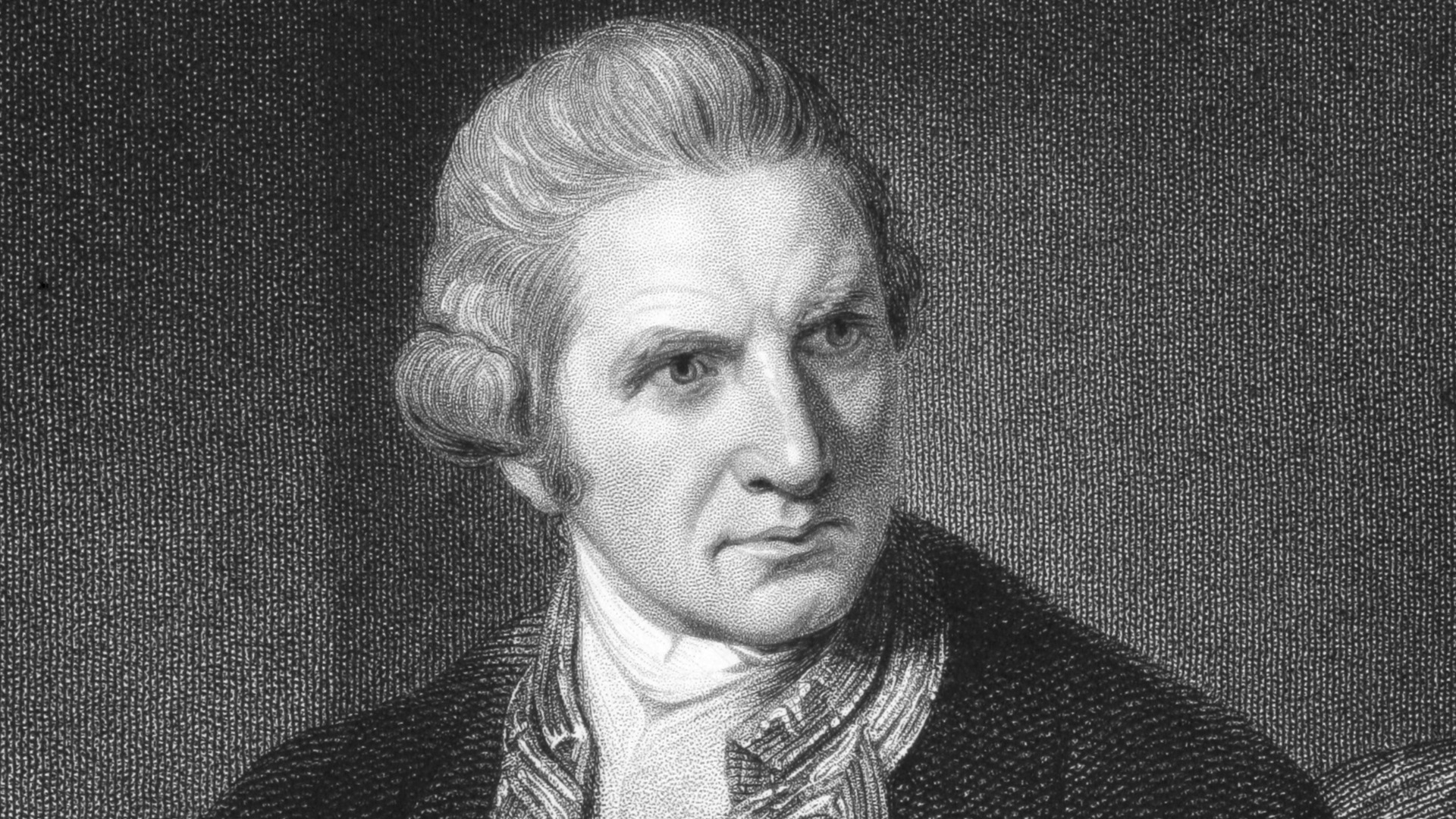
JAMES COOK (BRITISH EMPIRE / EXPLORATION ERA)
C. 1728 – 1779 AD
Table of Contents: James Cook

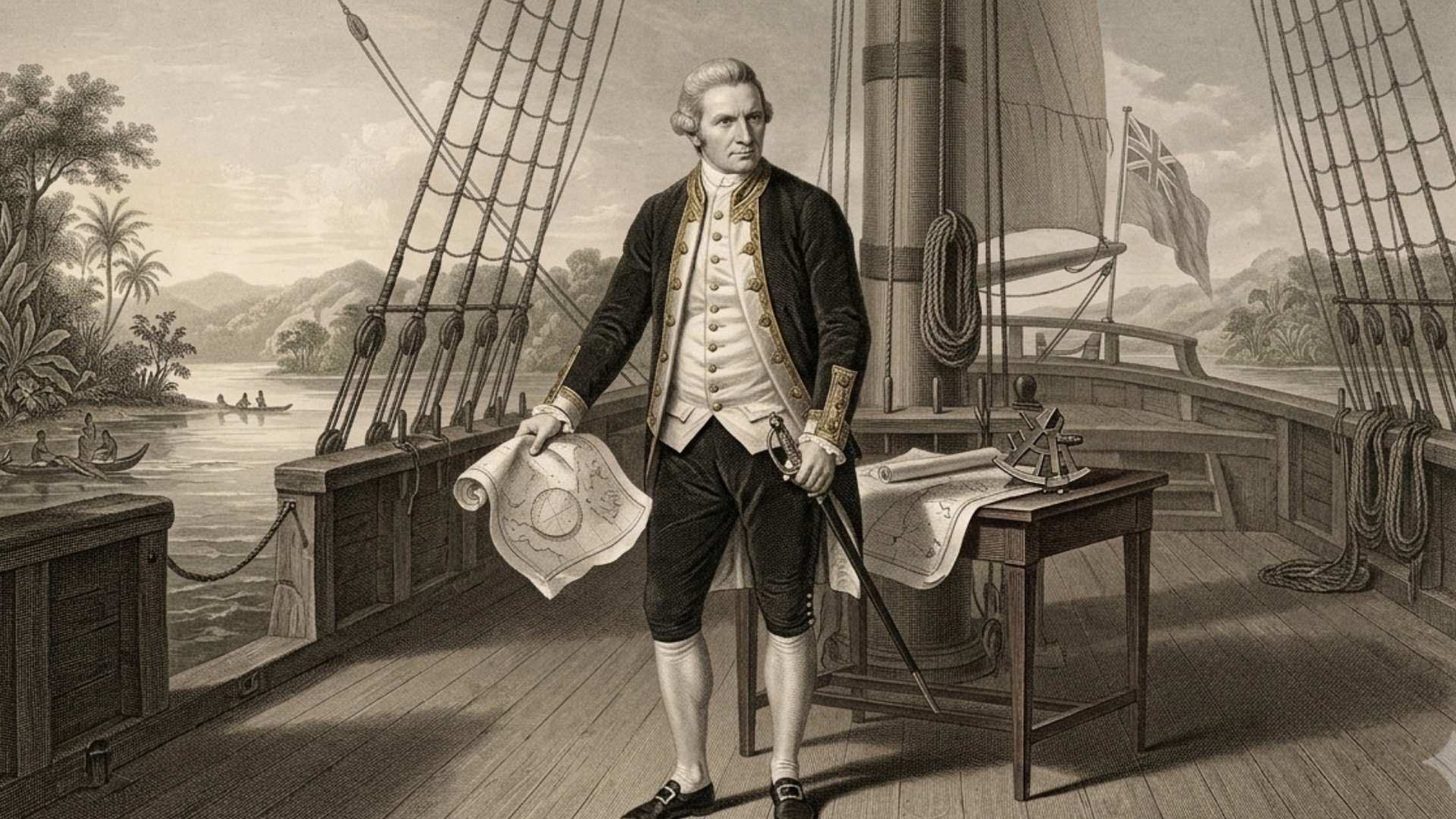
James Cook. His name denotes Yorkshire rural origins, emerging from the laboring class to become the most skilled hydrographer of his age. He rose within the Royal Navy through merit, technical expertise, and a ruthless commitment to systematic seafaring.

Marton, North Yorkshire (England). This region was a critical node for maritime commerce and coal transport. It provided the formative environment for Cook to master the difficult navigation of the North Sea.

C. 1768 – 1779 AD. These years encompass his three massive Pacific voyages. His command synthesized complex cartography, naval medicine, and astronomical observation into a unified, revolutionary maritime legacy.

Royal Navy and the Royal Society. He balanced the rigid demands of imperial naval service with the progressive, enlightened scientific objectives of the London intellectual elite.

Captain and Master Hydrographer. First promoted by the Admiralty after the successful charting of Newfoundland, this title honors his role in replacing maritime guesswork with the scientific rigor of triangulation.

He revolutionized global navigation by perfecting the use of the chronometer. He established the baseline for modern cartography and transformed maritime exploration into a systematic, data-driven discipline.

Transit of Venus observation, charting of New Zealand, mapping the Australian East Coast, second voyage searching for Antarctica, final Hawaiian expedition.

He implemented radical dietary changes, such as the mandated use of citrus, which saved countless crew lives from the devastating effects of scurvy.

| His legacy faces intense scrutiny regarding colonial impact and indigenous encounters. Modern archaeological recovery of his logs has vindicated his technical records while fueling vital debates on exploration ethics. |
“I had ambition not only to go farther than any man had been before, but as far as it was possible for a man to go.”
– James Cook
Overview: James Cook
The maritime expeditions of James Cook stand as the foundational scientific and geopolitical odyssey of the eighteenth-century Pacific. Commissioned by the British Admiralty and the Royal Society immediately following the Seven Years’ War, the voyages sought to expand imperial trade networks and record the transit of Venus. Captain James Cook acted as a studious hydrographic visionary, while his officers provided matchless open-ocean engineering skills. Together, they led diverse naval contingents through completely unmapped marine ecosystems. Their mission transcended simple flag-planting; it demanded the rigorous documentation of an entire ocean basin. By merging political ambition with Enlightenment curiosity, they redefined the parameters of state-sponsored exploration. Their efforts transformed Great Britain from an Atlantic maritime state into a dominant global empire.
Through meticulous personal observation and cross-examination of environmental evidence, they altered how humanity gathered geographic knowledge. They refused to rely on speculative Spanish charts or mythological Southern Continent folklore. Instead, they measured coastlines, calculated celestial longitudes using advanced chronometers, and preserved physical botanical specimens. They cross-examined diverse indigenous informants to chart treacherous reef passages. This direct empirical scrutiny invalidated centuries of geographical fantasy regarding the Pacific Ocean. Their systematic charts proved that the globe could be organized, indexed, and mastered through disciplined human intellect. By prioritizing empirical data over tradition, they established a new standard for international scientific expeditions.
Did you know? James Cook

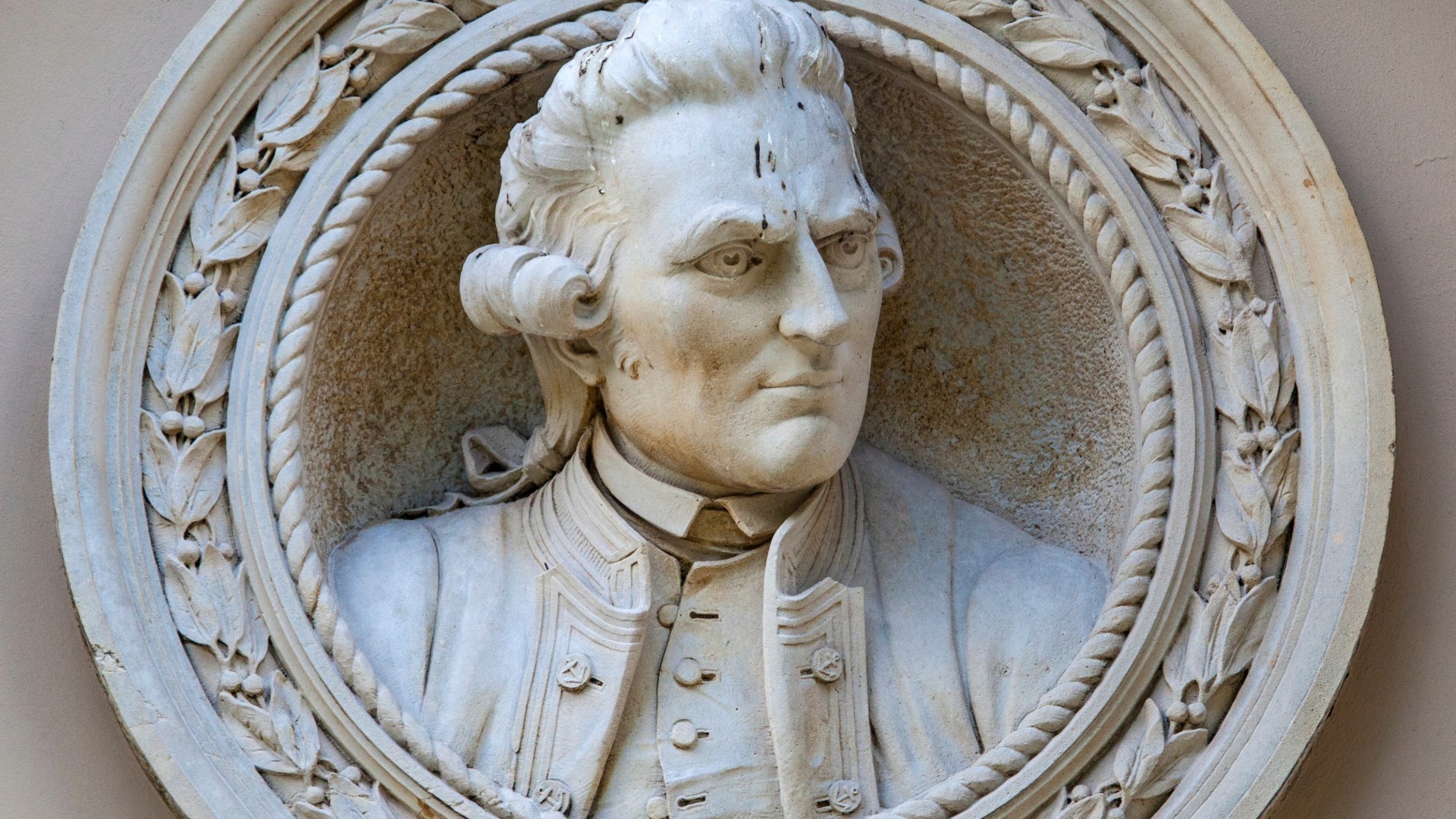
The Captain James Cook Statue, a detailed bronze sculptural monument by Sir Thomas Brock, stands permanently near Admiralty Arch in London, United Kingdom. This public installation depicts the navigator holding his signature coastal charts, capturing his likeness through eighteenth-century portraits preserved in the National Maritime Museum.

Critics once claimed his initial charts were based on borrowed, pre-existing French maps. Modern high-resolution digitizations of his original field drafts confirm that his triangulation methods were independently derived and vastly superior in accuracy.
| Cook utilized a highly advanced, customized brass sextant made by John Bird to secure precise lunar distance measurements on rolling quarterdecks. This physical apparatus enabled the immediate, daily recording of astronomical data under volatile open-ocean conditions. |
Timeline of James Cook
The chronological trajectory of James Cook maps the evolution of a coal-shipper into the world’s most successful explorer. Beginning with his maritime training in the North Sea, his timeline illustrates a move toward formal naval service followed by a radical shift into the vast, unknown Pacific. Each event reflects the broader imperial climate of the eighteenth century, where scientific discovery was inextricably linked to territorial and navigational goals. This timeline captures his development from a maritime apprentice to an expert navigator who systematically challenged the limits of his era. By recording his movements, we see an evolving chronicle of a man balancing personal conviction with the immense, unpredictable realities of the open ocean.
Timeline Chronology
| YEAR | EVENT | DESCRIPTION |
|---|---|---|
| 1755 | Naval Enlistment | Cook enters the Royal Navy as an able seaman, initializing his rapid ascent through specialized hydrographic ranks. |
| 1759 | St. Lawrence Survey | Cook charts the treacherous St. Lawrence River during the Seven Years’ War to enable Wolfe’s amphibious assault on Quebec. |
| 1763 | Newfoundland Mapping | He begins a multi-year, mathematically precise hydrographic survey of the Newfoundland coast using advanced triangulation techniques. |
| 1768 | First Voyage Departure | HMS Endeavour officially departs Plymouth, initiating the systematic scientific reconnaissance of the South Pacific Ocean. |
| 1769 | Transit of Venus | Cook establishes an astronomical observatory at Tahiti, securing vital solar distance calculations for the Royal Society. |
| 1769 | New Zealand Circumnavigation | The expedition meticulously charts both islands of New Zealand, disproving claims that they formed part of a massive southern continent. |
| 1770 | Australian East Coast Survey | Cook charts two thousand miles of uncharted Australian coastline, surviving a near-fatal grounding on the Great Barrier Reef. |
| 1771 | Triumphant Return | HMS Endeavour arrives back in England to massive public acclaim, completing their epic multi-year scientific voyage. |
| 1772 | Second Voyage Command | Cook departs on HMS Resolution to resolve the geopolitical mystery of the speculative Terra Australis Incognita. |
| 1773 | Antarctic Circle Crossing | The expedition achieves the first recorded maritime penetration of the Antarctic Circle, encountering extreme ice fields. |
| 1774 | Pacific Island Sweeps | Cook executes extensive sweeping loops across the South Pacific, mapping Easter Island, the Marquesas, and Vanuatu. |
| 1775 | Second Return | Cook reaches England, demonstrating that an elite crew could survive multi-year voyages without a single death from scurvy. |
| 1776 | Third Voyage Departure | HMS Resolution seeks the Northwest Passage, attempting to connect Pacific trade networks directly to the North Atlantic. |
| 1778 | Hawaiian Archipelagic Contact | The expedition makes historic initial contact with the Hawaiian Islands, documenting complex Polynesian social structures. |
| 1778 | Oregon-Alaska Mapping | Cook systematically maps the western coast of North America from Oregon up through the treacherous Bering Strait. |
| 1778 | Arctic Ice Barrier | The ships encounter an impenetrable wall of pack ice at seventy degrees North latitude, halting further northern progress. |
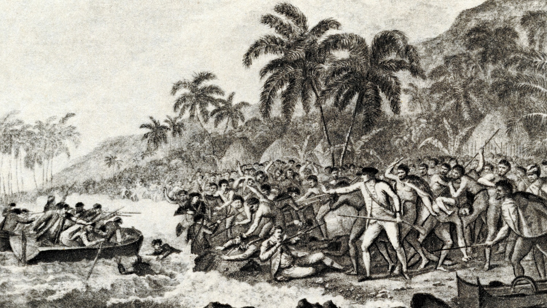
| 1779 | Kealakekua Return | Damaged masts force HMS Resolution back to Hawaii, setting off intense diplomatic frictions with local leaders. |
| 1779 | Kealakekua Bay Conflict | A violent skirmish results in Cook’s death on the beach, marking a tragic end to his operational career. |
| 1780 | Expedition Homecoming | The leaderless fleet returns to London, transferring a massive archive of charts and journals to the British Admiralty. |
| 1784 | Official Publication | The Admiralty publishes the official third voyage journals, permanently transforming global cartography and maritime history. |
Legacy of James Cook
James Cook’s work left an indelible mark on global geography and changed how modern states approached oceanic science. By turning speculative sea tracks into highly accurate charts, he gave later generations a dependable guide to the world’s largest ocean basin. His detailed maps cleared up centuries of geographical confusion, replacing wishful thinking with cold, hard numbers. As a result, future generations of sailors, merchants, and scientists used his work as the baseline for their own travels. He effectively closed the book on the era of accidental discovery, replacing it with a system of state-sponsored, highly planned research.
His work also reshaped the fields of botany, zoology, and anthropology by bringing a massive wave of new information back to European universities. The methods his crews developed for surveying coasts, calculating longitude, and keeping sailors healthy became standard practice across the Royal Navy. Thinkers all over Europe viewed his journals as a masterpiece of clear-headed, real-world research carried out under incredibly tough conditions. By pinning down the exact positions of hundreds of islands, he also drew the political borders that shaped the modern Pacific. Ultimately, his commitment to precision turned a dangerous series of sea voyages into a cornerstone of modern scientific knowledge.
Examples:
| Chronometer Navigation | Cook proved the value of Larcum Kendall’s K1 clock, showing that mechanical timekeeping was the best way to track longitude at sea. |
| Running Coastal Surveys | He perfected a method of charting coastlines while keeping his ship moving, using compass bearings and angles to sketch out massive shores quickly. |
| Nutritional Medicine | By making his crews eat sauerkraut, malt, and portable soup, he proved that scurvy was a preventable dietary issue rather than an inevitable risk of seafaring. |
| Strategic Charting | His accurate maps of the Canadian and Australian coasts gave the British government the reliable data it needed to expand its global empire. |
| Dugout Intercultural Work | He collaborated with the indigenous priest Tupaia to draw a map of the South Pacific, merging European surveying with native geography. |
| Hydographic Redundancy | Cook made his officers keep independent logbooks, ensuring that a single accident wouldn’t wipe out the expedition’s data. |
| Triangulation Gridwork | He used shore-based measuring lines to back up his sea charts, linking land surveying with ocean navigation. |
| Pacific Language Studies | His teams collected matching word lists across different islands, proving that Polynesian cultures shared a common historical root. |
| Meteorological Tracking | The expedition kept meticulous records of trade winds, currents, and storms, creating the first comprehensive weather map of the Pacific. |
| Resource Appraisal | Cook looked at every new land with a practical eye, grading the timber, soil, and bays for their future military or commercial use. |
| Reef Navigation Tactics | He developed methods for getting heavy ships through coral reefs, using small rowboats to scout out channels ahead of the main vessel. |
| Empirical Discipline | He refused to include unverified or legendary islands on his maps, leaving blank spaces rather than repeating old sailors’ tales. |
| Scientific Command | Cook created an operational system where civilian scholars, painters, and naval officers worked together as a single team. |
| Visual Archaeology | The detailed drawings made by his shipboard artists provided a reliable, real-world record of Pacific life before Western contact. |
| Deep-Sea Soundings | The crew took regular depth measurements in open water, providing the first real data on the topography of the Pacific ocean floor. |
Additional Achievements of James Cook
The core of James Cook’s success lay in his total dedication to real-world observation and orderly record-keeping. He did not view the Pacific as a theater for romantic adventure, but as a vast grid of data that needed to be filled with precise measurements. His analytical mind allowed him to break down complex, unfamiliar environments into clear, useful pieces of information. By using standardized instruments even during heavy gales, he made sure his personal feelings didn’t skew his geographical reports. This focus on accuracy changed the whole field of travel writing, moving the spotlight away from personal exploits toward verifiable facts. His career proved that the world’s most chaotic environments could be mapped through sheer focus and disciplined thinking.
On the operational side, pulling off these voyages required incredible logistical skill and total control over his specialized crews. Cook ran long, isolated supply lines across thousands of miles of open water without any outside help or bases. His careful, measured approach to island politics handled complex cross-cultural encounters without triggering immediate warfare. By executing his plans with absolute care, he extended the reach of British law and science into the farthest corners of the globe. The sheer scale of his geographical work set a new standard that changed how modern governments organized their navies. His success stands as a monument to what can be accomplished when scientific curiosity is backed up by strict military discipline.
Examples:
| Total Blue-Water Tracking | Over two hundred thousand nautical miles logged across three separate Pacific expeditions. |
| Antarctic Boundary Lines | Three separate seasonal probes executed across the frozen southern parallels to locate land. |
| Farthest Southern Coordinate | Seventy-one degrees ten minutes South latitude reached amidst dense pack ice fields. |
| Farthest Northern Penetration | Seventy degrees forty-four minutes North latitude reached before encountering the Arctic ice wall. |
| Barrier Reef Grounding Time | Twenty-three hours spent stuck on sharp coral while the crew threw heavy gear overboard to float the ship. |
| Scurvy Mortality Rate | Zero men lost to scurvy across years of continuous open-ocean sailing. |
| New Zealand Survey Time | Six months of non-stop coastal charting to trace the complete shape of both islands. |
| Total Pacific Islands Mapped | Dozens of unique islands and archipelagos given their first fixed spots on global maps. |
| Astronomy Station Footprint | A fortified earthen redoubt built at Point Venus to protect the transit instruments. |
| Australian Coastline Log | Two thousand miles of highly dangerous shoreline traced and charted on a single voyage. |
| Total Chronometers Maintained | Four elite timepieces carried on the second voyage to test their accuracy at sea. |
| Chronometer Daily Drift rate | Less than one second per day of timekeeping error maintained by the K1 clock. |
| Total Natural History Draw | Thousands of highly detailed scientific sketches and finished paintings brought back to London. |
| New Botanical Specimens | Hundreds of completely new plant species collected and classified by accompanying scientists. |
| Expedition Log Duplication | Every officer’s personal journal collected by the Admiralty to secure the geographic data. |
| Average Crew Complement | One hundred and twelve men managed and kept alive under tight shipboard discipline. |
| Total Official Report Volumes | Three massive, data-heavy volumes published by the government to reveal his third-voyage findings. |
| Triangulation Baselines | Dozens of fixed physical shore markers set up to build accurate coastal grids. |
| Whitby Collier Cargo Tonnage | Three hundred and sixty-six tons of storage space provided by the tough hull of HMS Endeavour. |
| Archival Material Survival | One hundred percent of his primary field logs, charts, and sailing journals preserved. |
References and Citations
- Beaglehole, J. C. (1974). The life of Captain James Cook. Stanford University Press.
- Cook, J. (1955). The journals of Captain James Cook on his voyages of discovery. Cambridge University Press.
- Thomas, N. (2003). Discoveries: The voyages of Captain James Cook. Allen Lane.
- Withey, L. (1989). Voyages of discovery: Captain Cook and the exploration of the Pacific. University of California Press.
- Obeyesekere, G. (1992). The apotheosis of Captain Cook: European mythmaking in the Pacific. Princeton University Press.
- Sahlins, M. (1995). How “natives” think: About Captain Cook, for example. University of Chicago Press. [1]