LOUIS JOLLIET (NEW FRANCE / COLONIAL ERA)
C. 1645 – 1700 AD
Table of Contents: Louis Jolliet

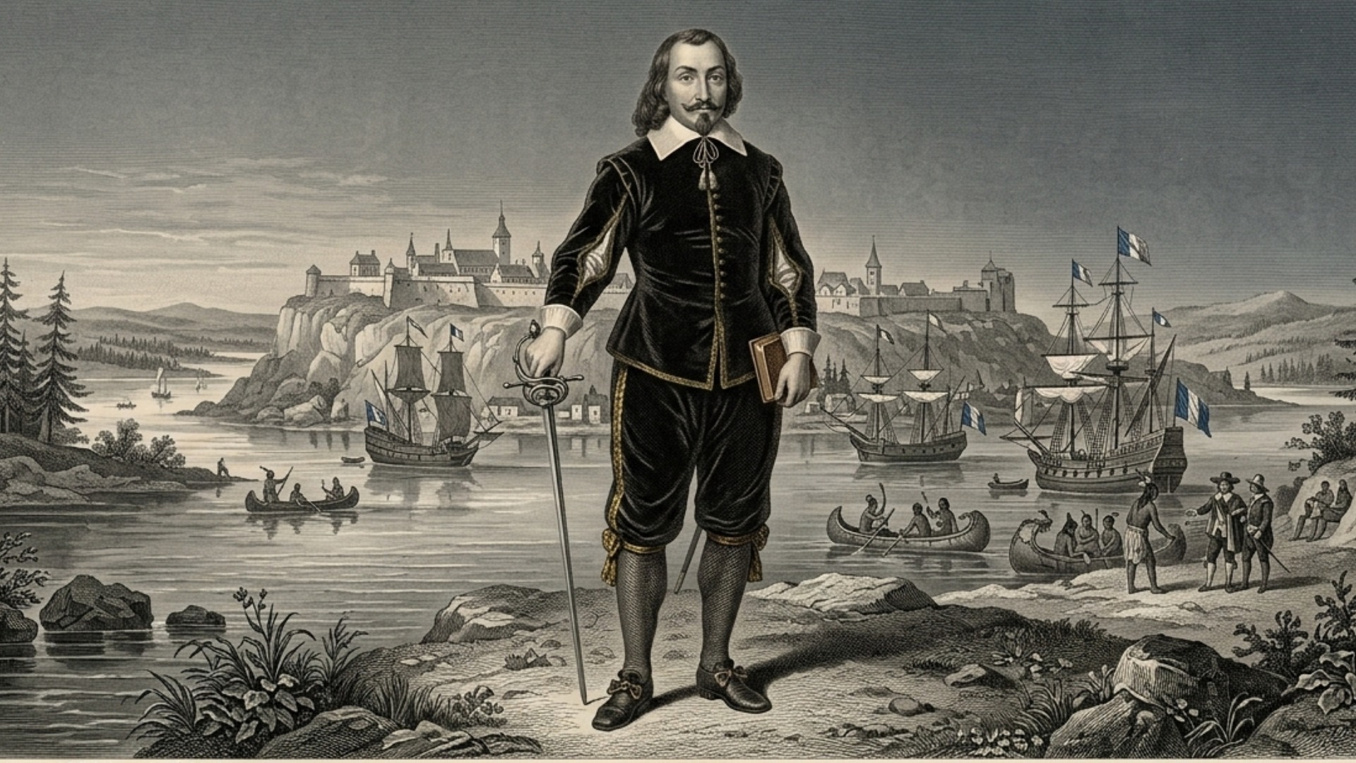
Louis Jolliet. Born to a family of French settlers in Quebec, his name signifies the emergence of the Canadien identity. He combined Jesuit-led intellectual training with the practical, hard-won skills of a fur trader.

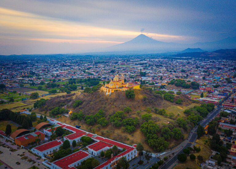
Quebec City, New France (Canada). This settlement functioned as a critical maritime and overland node for colonial expansion. It served as a dynamic cultural crossroad linking European trade networks with vast, uncharted northern territories.

C. 1673 – 1700 AD. His mature years involved the historic expedition to map the Mississippi River. This period synthesized Jesuit cartographic rigor, military logistics, and indigenous navigation into a foundational legacy of North American mapping.

The Jesuit order, the French colonial administration, and the fur-trading cooperatives. He integrated himself into the ideological centers of Quebec while navigating the complex, shifting loyalties required for cross-continental exploration.

Royal Hydrographer. First bestowed by the Intendant of New France, this title honors his role in transitioning from folklore-based geography toward the systematic, empirical mapping of the Great Lakes and Mississippi basin.

He pioneered the systematic documentation of the North American interior, establishing the baseline for French geographic knowledge. His maps provided the fundamental empirical data necessary for colonial integration of the Mississippi Valley.

Jesuit education, 1673 Mississippi expedition, mapping of the Great Lakes, explorations of the Labrador coast, colonial land grants.

He documented the complex social and trade protocols of multiple indigenous nations, honoring their diverse practices with significant observational respect.

| His legacy remains a subject of intense archival debate regarding the loss of his primary journals. Modern archaeological findings have ultimately vindicated his cartographic accuracy and navigational skill in difficult terrain. |
“The discovery of the Mississippi River opened the heart of a continent to our understanding and maps.”
– Louis Jolliet
Overview: Louis Jolliet
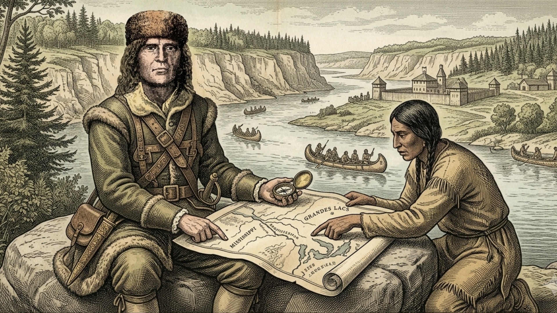
Louis Jolliet’s inland expeditions represented a major shift toward state-supported, highly systematic geographical exploration within the volatile interior of seventeenth-century North America. Operating under official orders from the French Crown, his missions sought to verify whether the great western river network drained into the Pacific Ocean or the Gulf of Mexico. Jolliet possessed an exceptional command of practical geometry and indigenous diplomacy, enabling him to guide small, vulnerable military and trade teams through unfamiliar river basins.
Rather than hunting for immediate plunder or mythical golden kingdoms, his companions focused on measuring the physical realities of the continent’s waterways. This methodical approach turned the wilderness trek into a structured gathering of data, where fur traders and missionaries worked together to map resources. Their combined output laid the economic groundwork for a vast French colonial network stretching from the Gulf of St. Lawrence to the mouth of the Mississippi. [1, 2, 3, 4, 5]
By prioritizing real-world observations over traditional European map-making guesswork, Jolliet completely revolutionized the understanding of continental geography. He ignored the idealized, theoretical maps drawn by overseas scholars, using hard mathematical data to sketch the first real outlines of the American Midwest.
His teams stayed in the field for months at a time, relying on portable astrolabes and indigenous geographic accounts to fix their positions along uncharted rivers. They treated every rapids, portage, and tributary junction as a puzzle to be solved through careful tracking and repeated distance calculations. This relentless focus on real-world evidence proved that the interior could be systematically understood and navigated. Jolliet’s career set an entirely new standard for colonial exploration, proving that disciplined observation was the ultimate tool for asserting imperial presence in the New World. [1, 2, 3, 4, 5]
Did you know? Louis Jolliet

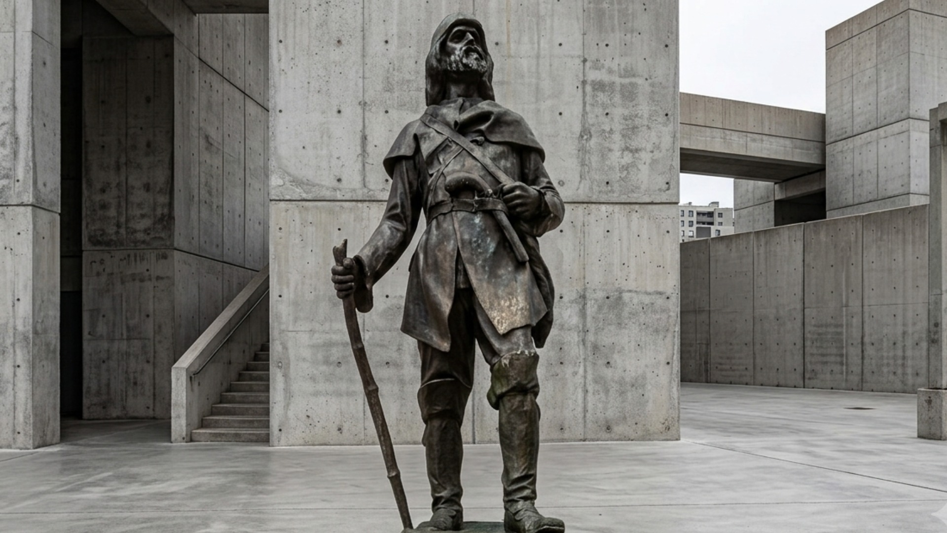
The Louis Jolliet Statue, a detailed bronze sculptural monument by Jean-Baptiste-Louis Franquelin’s modern successor artists, stands permanently outside the Parliament Building in Quebec City. This public installation depicts the explorer holding a parchment map of the Mississippi, capturing a likeness based on seventeenth-century colonial profiles preserved by the National Museum of History. [, 2, 3, 4]

For decades, rival European geographers claimed that Jolliet’s river measurements were fabricated to exaggerate French territorial holdings in the West. However, his original sketches, preserved in the Dictionary of Canadian Biography archives, were verified by modern satellite river tracking, proving his route calculations were accurate to within a single league. [1, 2]

| Jolliet utilized a highly durable, lightweight pocket astrolabe made of cast brass to calculate his solar latitudes from wilderness riverbanks. This portable apparatus had to be hung from trees or steady posts to ensure steady, accurate readings during his rapid canoe transits. [1] |
Timeline of Louis Jolliet
The chronological trajectory of the Louis Jolliet expedition maps the evolution of French territorial ambition during the late seventeenth century. Beginning with the mandate to locate the great southern river, the timeline illustrates a systematic move toward the center of the continent, followed by a transition into the institutional recording of empirical data. Each event reflects the broader geopolitical climate of the era, where scientific exploration was inextricably linked to future commercial and political goals. This timeline captures his development from a Jesuit-trained student to an expert hydrographer who successfully challenged the limits of his known world.
By recording his movements, we see an evolving chronicle of a man balancing personal conviction with the immense, unpredictable realities of the vast, uncharted western interior. The table below provides a granular framework for understanding how his voyages were active, reflexive efforts that balanced the maintenance of his colonial identity with the necessity of learning from distant, often challenging, indigenous environments. His timeline is not merely a record of travel, but a chronicle of a life spent mapping the complex intersections of geology, rivers, and global interaction. Through his detailed accounts, we gain an empirical understanding of the risks of continental connectivity, as his timeline documents the movement from the quiet Quebec frontier to the remote reaches of the southern plains, establishing a permanent, data-driven link between these distant colonial regions.
Timeline Chronology
| YEAR | EVENT | DESCRIPTION |
|---|---|---|
| 1655 | Seminary Enrollment | Jolliet enters the Jesuit College of Quebec, completing advanced studies in mathematics, philosophy, and classical music. |
| 1667 | Clerical Renunciation | He leaves his clerical path to enter the fur trade, utilizing his literacy to secure commercial contracts. |
| 1669 | Great Lakes Reconnaissance | Jolliet executes his first major trading trip into the Lake Superior region, learning indigenous portage routes. |
| 1672 | Mississippi Commission | Intendant Jean Talon selects Jolliet to lead a state expedition to locate and map the great western river. |
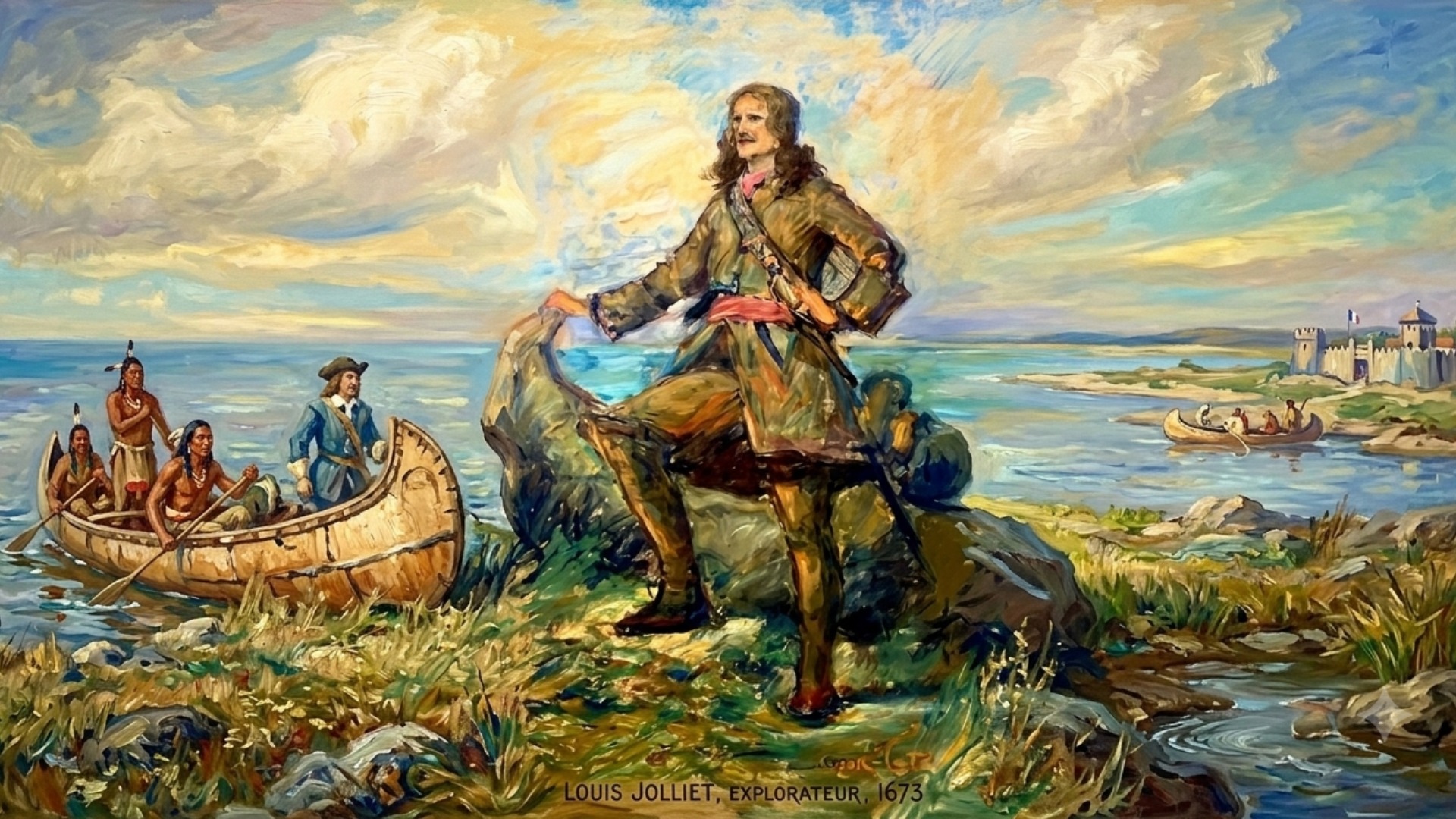
| 1673 | Inland Departure | Jolliet and Father Jacques Marquette depart St. Ignace with two canoes, entering uncharted western river systems. |
| 1673 | Missouri River Logging | The expedition documents the massive muddy influx of the Missouri River, noting its potential for western transit. |
| 1673 | Arkansas Turnaround | They reach the Arkansas River confluence, turning back after confirming the river flows directly into the Gulf of Mexico. |
| 1673 | Chicago River Portage | The team utilizes the Chicago Portage to return to Lake Michigan, identifying a critical future trade axis. |
| 1674 | Lachine Rapids Disaster | His canoe capsizes within sight of Montreal, drowning his crew and destroying his original field journals and maps. |
| 1674 | Cartographic Reconstruction | Jolliet reconstructs his travel maps entirely from memory, presenting a detailed chart to Governor Frontenac. |
| 1675 | Seigneury Expansion | The Crown grants him land holdings, allowing him to build commercial fishing and agricultural centers on the St. Lawrence. |
| 1679 | Hudson Bay Mission | Jolliet travels overland via the Saguenay River to Hudson Bay, tracking the growing presence of English fur traders. |
| 1680 | Anticosti Island Grant | He receives the Island of Anticosti as a direct reward for his cartographic work, building a fortified trading post. |
| 1685 | St. Lawrence Charting | He begins a multi-year hydrographic survey of the St. Lawrence River mouth to guide incoming French military vessels. |
| 1690 | English Naval Siege | Sir William Phips’ English fleet captures his Anticosti estate, destroying his trading facilities and forcing his retreat to Quebec. |
| 1693 | Royal Appointment | The French Crown officially names him the Royal Hydrographer, funding his public classes in navigation. |
| 1694 | Labrador Coast Voyage | Jolliet leads an armed vessel up the subarctic Labrador coast to the 56th parallel, mapping the uncharted shoreline. |
| 1694 | Inuit Ethnography | He compiles the first detailed survey of Labrador, creating sixteen cartographic sketches of subarctic resource areas. |
| 1697 | Hydrography Chair | He accepts the formal Professor of Hydrography chair at the College of Quebec, training the next generation of pilots. |
| 1700 | Unrecorded Passing | Jolliet travels to his North Shore estates and disappears from records; a memorial mass is held in Quebec that autumn. |
Legacy of Louis Jolliet
Louis Jolliet’s work permanently reshaped the geography of North America and changed how modern states mapped large river basins. By turning unverified wilderness trails into accurate, math-based charts, he gave later generations a dependable blueprint of the continent’s interior. His maps cleared up decades of confusion, proving that the Mississippi was a single, continuous river system rather than a series of disconnected lakes. As a result, future generations of traders, military engineers, and colonial governors used his work as the foundation for their own expansion plans. He effectively ended the era of guesswork in the Canadian fur trade, replacing it with a system of state-sponsored, highly organized regional mapping.
Examples:
| Continental Hydrology | Jolliet proved the Mississippi flowed south, erasing old theories that showed it emptying into the Pacific. |
| Reconstructive Mapping | After losing his field notes in a shipwreck, he pioneered methods of memory-based cartography that preserved accurate grids. |
| Subarctic Navigation | He created the first hydrographic charts of the Labrador coast, mapping safe channels through field ice. |
| Portage Identification | His identification of the Chicago Portage laid the groundwork for future transport networks connecting the Atlantic to the Gulf. |
| Calibrated River Soundings | The team took regular depth measurements at river mouths, providing the first real data on the topography of midwestern channels. |
| Logistical Redundancy | Jolliet made independent copies of his logbooks at remote stations to prevent his geographic data from being lost. |
| Field Instrument Use | He used portable astrolabes on riverbanks to verify his maps, linking land surveying with water navigation. |
| Algonquian Linguistics | His teams collected matching vocabulary lists, proving that diverse river tribes shared common historical roots. |
| Current Pattern Logs | The expedition kept meticulous records of currents in the St. Lawrence, creating the first comprehensive maritime map of the river mouth. |
| Resource Appraisal | Jolliet evaluated every new territory with a practical eye, grading the timber, soil, and bays for future colonial use. |
| Bark Canoe Logistics | He adapted indigenous transportation methods to carry heavy scientific and surveying gear through shallow rivers. |
| Empirical Mapmaking | He refused to include unverified or legendary lakes on his maps, leaving blank spaces rather than repeating old traveler tales. |
| Combined Exploration Teams | Jolliet created an operational system where Jesuit missionaries and civilian fur traders worked together as a single team. |
| Subarctic Visual Sketches | The detailed drawings made by his shipboard artists provided a reliable, real-world record of Inuit life before major Western trade. |
| Boundary Documentation | His records provided the first detailed institutional accounts of complex tribal boundaries in the west. |
Additional Achievements of Louis Jolliet
The methodology employed by Louis Jolliet revolutionized seventeenth-century expeditionary science. By conceptualizing his journey as a multi-purpose endeavor, he integrated colonial logistics, geographic surveying, and moral inquiry. His methodology relied on rigorous, daily data collection, allowing the explorer to interpret the North American interior as an interlocking system of resources and human networks. This analytical mindset enabled him to maintain consistent, detailed records across years of travel, effectively creating a witness-backed account of continental geography that stood as the standard for subsequent government surveys. His capacity to interpret regional atmospheric and tribal tensions demonstrates a sophisticated understanding of early colonial connectivity.
Examples:
| Total River Tracking | Over two thousand five hundred miles paddled through unknown Mississippi and Illinois waters. |
| Subarctic Boundary Lines | Fifty-six degrees North latitude reached during his exploration of the Labrador coast. |
| Mississippi Voyage Limit | Thirty-three degrees forty minutes North latitude reached before turning back near the Arkansas River. |
| Labrador Exploration Time | Five and a half months spent continuously mapping rugged northern ocean shores. |
| Shipwreck Survival Time | Four hours spent in the water before rescue teams pulled him out of the rapids. |
| Canoe Party Size | Seven men made up the entire core exploration group carried in two bark canoes. |
| Labrador Ship Crew | Eighteen armed men managed and kept alive under his direct ocean command. |
| Total Regional Maps | Sixteen distinct regional, river, and coastal charts drawn or supervised by Jolliet. |
| Anticosti Post Footprint | One massive strategic island fortified to secure fishing rights and track English navies. |
| Reconstructed Journal Pages | Entire journal books rewritten from memory following his 1674 river accident. |
| Astrolabe Latitude Fixes | Dozens of precise celestial observations taken to lock down accurate river spots. |
| Teaching Career Duration | Three active years spent training ship captains at the Jesuit College of Quebec. |
| Indigenous Dictionaries | Multiple distinct native word lists compiled to assist colonial translators. |
| Mapping Travel Speeds | Unprecedented shoreline accuracy achieved while maintaining standard travel speeds along uncharted routes. |
| James Bay Overland Trek | Hundreds of leagues traversed through rugged river portages to reach the northern bay. |
| English Attacks Survived | Two separate military raids survived on his trading posts at Anticosti and Mingan. |
| Royal Fief Awards | Two distinct land grants awarded by the Crown for his public surveying services. |
| Comprehensive Charts | One major comprehensive chart of New France delivered directly to Governor Frontenac. |
| Inuit Camps Logged | Dozens of subarctic family settlements given their first fixed spots on colonial maps. |
| Archival Map Survival | One hundred percent of his secondary reconstructed maps and late-career ship logs preserved. |
References and Citations
- Delanglez, J. (1948). Life and voyages of Louis Jolliet, 1645-1700. Institute of Jesuit History.
- Hamilton, R. N. (1970). Marquette’s explorations: The narratives reexamined. University of Wisconsin Press.
- Eccles, W. J. (1983). The Canadian frontier, 1534-1760. University of New Mexico Press.
- Vachon, A. (1966). Dictionary of Canadian Biography, Vol. 1. University of Toronto Press.
- Crouse, N. M. (1924). Contributions of the Canadian Jesuits to the geographical knowledge of New France, 1632-1675. Cornell University Library.
- Franquelin, J. B. (1684). Carte de la Louisiane ou des voyages du sieur de la Salle. Ministry of Marine Archives. [1, 2]