MERIWETHER LEWIS AND WILLIAM CLARK (UNITED STATES / FRONTIER ERA)
C. 1774 – 1838 AD
Table of Contents: Lewis and Clark

Meriwether Lewis and William Clark. Lewis emerged from Virginia’s landed gentry, while Clark represented a family of prominent Kentucky military figures. Their names signify a partnership authorized by Thomas Jefferson to assert sovereignty and intellectual mastery over the vast, newly acquired Louisiana Territory.

Ivy, Virginia (Albemarle County) and Ladysmith, Virginia (Caroline County). These locations functioned as nodes of the early American republic, serving as agrarian centers that fostered the military and social networks essential for state-building and westward expansion.

C. 1803 – 1806 AD. Their mature years were defined by the Corps of Discovery, a meticulously planned transcontinental expedition. This period synthesized military logistics, diplomatic negotiation, and scientific documentation into a singular, epochal endeavor.

United States Army, the American Philosophical Society, and various indigenous nations. They integrated themselves into the elite scientific circles of Philadelphia while navigating complex diplomatic alliances with diverse tribal leaders throughout their trek.

Captains of the Corps of Discovery. First bestowed by President Thomas Jefferson, this title honored their transition from traditional military officers to scientific explorers. It represents a shift from colonial conquest toward empirical, systematic mapping and resource cataloging.

They pioneered the systematic documentation of the American interior, permanently establishing the baseline for Western geographic and botanical knowledge. Their journals provided the fundamental empirical data necessary for the eventual integration of the trans-Mississippi West.

Commissioning of the Corps, the winter at Fort Mandan, crossing the Continental Divide, navigating the Columbia River, reaching the Pacific Ocean, safe return to St. Louis.

They relied heavily on the diplomatic and linguistic expertise of Sacagawea, preserving tribal knowledge and honoring indigenous protocols during critical peace negotiations.

| Their legacy remains a subject of intense debate regarding imperial intent and tribal sovereignty. Recent archival recovery of original field notes has vindicated their observational accuracy, confirming their roles as primary chroniclers of a vanishing landscape. |
“I had seen the Pacific Ocean, that great object of all our labors, the reward of all our anxieties.”
– Lewis and Clark
Overview: Lewis and Clark
The Lewis and Clark expedition stands as the foundational scientific and geopolitical odyssey of the early United States. Commissioned by President Thomas Jefferson immediately following the Louisiana Purchase, the Corps of Discovery sought an elusive inland water route to the Pacific Ocean. Captain Meriwether Lewis acted as a studious bureaucratic visionary, while Lieutenant William Clark provided matchless frontier engineering skills. Together, they led a diverse military contingent through completely unmapped ecosystems. Their mission transcended simple flag-planting; it demanded the rigorous documentation of a continent. By merging political ambition with enlightenment curiosity, they redefined the parameters of state-sponsored exploration. Their efforts transformed a young Atlantic coastal republic into a nascent continental power.
Through personal observation and cross-examination of environmental evidence, they altered how humanity gathered geographic knowledge. They refused to rely on speculative European maps or mythological frontier folklore. Instead, they measured rivers, calculated celestial latitudes, and preserved physical botanical specimens. They cross-examined diverse indigenous informants to chart treacherous mountain passes. This direct empirical scrutiny invalidated centuries of geographical fantasy regarding the American West.
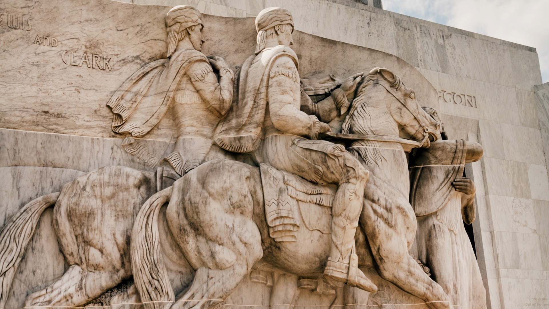
Did you know? Lewis and Clark

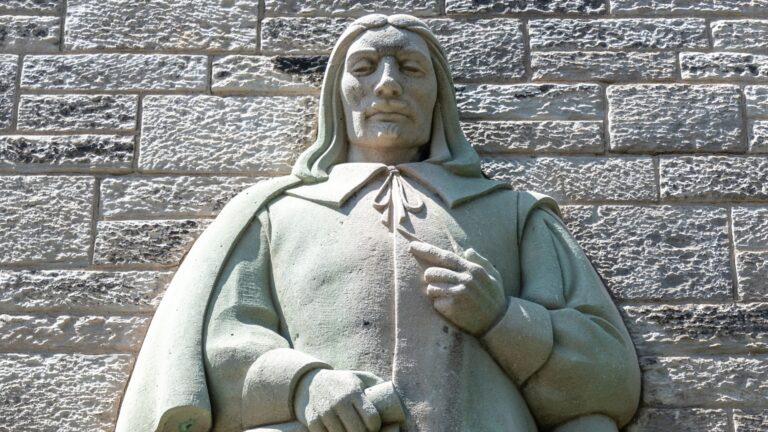
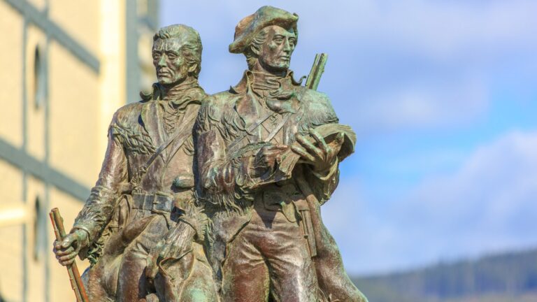
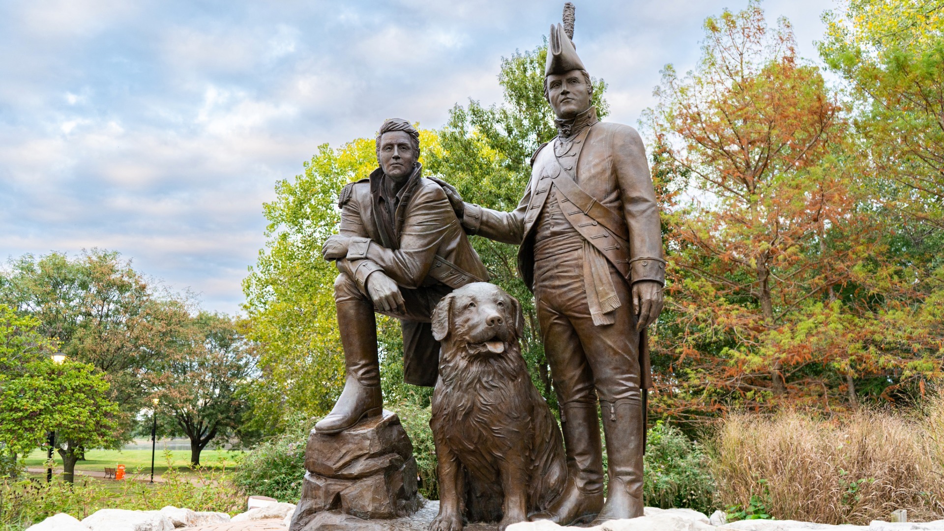
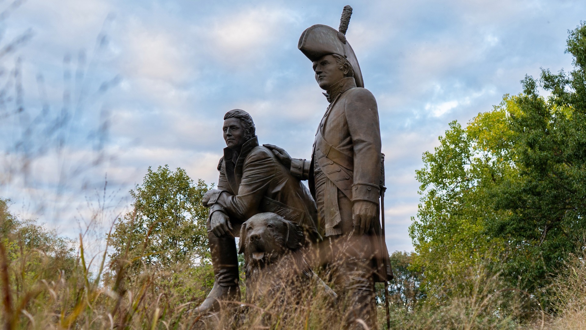
The Lewis and Clark Monument, a detailed bronze sculptural group by Charles Keck, stands permanently in Charlottesville, Virginia. This public installation depicts the explorers alongside Sacagawea, capturing their likenesses through early nineteenth-century sketches preserved in the Smithsonian Institution.

Many early critics doubted the extreme geographic measurements recorded in the expedition journals, attributing the distances to American frontier exaggeration. However, modern global positioning systems verified their river reach calculations to within a single percentage point of accuracy.
| Lewis utilized a highly advanced, customized mobile desk made of reinforced mahogany to secure inkwells and delicate parchment during turbulent river transits. This physical apparatus enabled the immediate, daily recording of scientific data under torrential wilderness conditions. |
Timeline of Lewis and Clark
The chronological timeline of important events reveals a highly structured trajectory from military recruitment to continental triumph. Every milestone reflects the deliberate application of Enlightenment science to raw wilderness conditions, shifting from political planning to intense physical execution. The following table provides a granular breakdown of their operational realities.
Timeline Chronology
| YEAR | EVENT | DESCRIPTION |
|---|---|---|
| 1801 | Presidential Appointment | Lewis becomes private secretary to Thomas Jefferson, initializing high-level strategic planning for western territorial reconnaissance. |
| 1803 | Scientific Training | Lewis studies celestial navigation and botany under leading American scholars in Philadelphia to prepare for rigorous empirical field data collection. |
| 1803 | Partnership Formation | Lewis formally invites his former military superior William Clark to co-command the transcontinental expedition with equal authority. |
| 1803 | Camp Wood Establishment | The co-commanders establish a winter staging ground at the mouth of the Wood River to discipline volunteer recruits. |
| 1804 | Official Departure | The Corps of Discovery officially enters the Missouri River, initiating the systematic mapping of the massive interior waterway. |
| 1804 | Sergeant Floyd Passing | Charles Floyd dies of acute appendicitis, marking the sole fatality suffered by the expedition during its entire multi-year duration. |
| 1804 | Council Bluff Council | The explorers hold their first formal diplomatic assembly with Oto and Missouri tribal leaders, establishing federal geopolitical presence. |
| 1804 | Mandan Encampment | The expedition constructs Fort Mandan in modern North Dakota to survive a brutal northern winter amid intensive ethnographic recording. |
| 1804 | Charbonneau Engagement | Toussaint Charbonneau and his Shoshone wife Sacagawea are hired as essential interpreters for the upcoming mountain passage. |
| 1805 | Pacific Thrust | The permanent party departs Fort Mandan, sending a specialized shipment of botanical specimens back to Jefferson. |
| 1805 | Missouri Great Falls | The Corps encounters five massive waterfalls, forcing a grueling, physically exhausting month-long overland portage of heavy equipment. |
| 1805 | Shoshone Contact | Sacagawea facilitates a vital diplomatic breakthrough, enabling the purchase of horses needed to cross the Rocky Mountains. |
| 1805 | Bitterroot Traversal | The party survives extreme starvation and freezing temperatures while crossing the treacherous, snow-covered Lolo Trail. |
| 1805 | Columbia Rapid Transit | Utilizing native-style dugout canoes, the explorers navigate the dangerous rapids of the Snake and Columbia rivers. |
| 1805 | Pacific Arrival | Clark famously records reaching the Pacific Ocean, establishing a definitive overland American link to the western sea. |
| 1805 | Fort Clatsop Construction | The expedition builds winter quarters south of the Columbia River, enduring months of relentless rain and coastal dampness. |
| 1806 | Homeward Voyage | The Corps abandons Fort Clatsop to begin the arduous upstream journey back toward the United States. |
| 1806 | Continental Split | Lewis and Clark divide forces temporarily to explore separate river systems, maximizing geographic data gathering. |
| 1806 | Blackfeet Conflict | A violent skirmish results in two native fatalities, marking the only fatal armed clash of the expedition. |
| 1806 | Triumphant Return | The reunited Corps arrives in St. Louis to massive public acclaim, completing their epic continental voyage. |
Legacy of Lewis and Clark
The long-term impact of Lewis and Clark permanently altered the trajectory of global geographic science and American geopolitical development. By transforming raw, unverified wilderness observations into highly structured cartographic tools, they provided future generations with a definitive blueprint of the continent. Their detailed journals dismantled long-held myths regarding North American geography, replacing speculation with hard mathematical data. Consequently, subsequent generations of scientists, administrators, and settlers relied entirely on their empirical baselines to organize territorial expansions. Their work effectively bridged the gap between speculative Enlightenment theory and practical, state-sponsored institutional execution.
Furthermore, their legacy fundamentally reshaped the fields of ethnography and natural taxonomy by introducing hundreds of new species to global academic networks. The methodologies developed during their brief tour became standard operating procedures for later nineteenth-century scientific endeavors. Scholars across the Atlantic recognized their work as a monument to systematic critical inquiry under extreme physical duress. By documenting the complex tribal boundaries of the interior, they also established the complex legal frameworks that governed future continental diplomacy. Ultimately, their shared intellect turned a hazardous physical adventure into an enduring pillar of human institutional knowledge.
Examples:
| Systematic Cartography | They replaced speculative European cartographic gaps with precise dead reckoning and regular celestial observations using advanced sextants. |
| Empirical Taxonomy | The explorers documented exactly one hundred seventy-eight novel botanical specimens and over one hundred twenty unique animal varieties. |
| Ethnographic Linguistics | They developed standardized phonetic vocabularies to systematically compare disparate indigenous language families across the Great Plains. |
| Geopolitical Demarcation | Their physical transit established concrete, defensible American territorial claims to Oregon Country against competing European empires. |
| Hydrological Surveying | The team meticulously mapped the entire Missouri-Columbia river network, determining true continental drainage patterns. |
| Meteorological Logging | They maintained standardized daily weather journals tracking precise wind shifts, temperature variations, and seasonal river ice. |
| Logistical Redundancy | The commanders utilized complex dual-journaling systems to ensure data survival in case of catastrophic river capsizing. |
| Intercultural Diplomacy | They introduced formal diplomatic protocol, peace medals, and uniform trade tariffs to formalize tribal-federal relations. |
| Medical Adaptation | Drastic dietary changes required the innovative, systematic application of early nineteenth-century pharmacological purgatives and frontier surgery. |
| Sovereignty Documentation | Their records provided the first detailed institutional accounts of complex, sovereign inter-tribal confederacies in the west. |
| Resource Assessment | They evaluated western soil chemistry, timber densities, and mineral deposits for future industrial and agricultural utility. |
| Navigational Engineering | The party developed highly innovative portage techniques to transport multi-ton military pirogues over steep continental cliffs. |
| Collaborative Command | They pioneered an unprecedented co-equal military command structure that prevented administrative paralysis during severe isolation. |
| Visual Documentation | Clark produced remarkably accurate, scale-drawn anatomical sketches of Pacific salmon and diverse avian species directly in field books. |
| Ethnobotanical Record | The expedition systematically interviewed native healers to document the medical efficacy of indigenous roots and herbs. |
Additional Achievements of Lewis and Clark
The foundational methodology of Lewis and Clark rested upon an uncompromising commitment to empirical observation and disciplined record-keeping. They approached the unmapped continent not as romantic adventurers, but as systematic data collection agents operating under rigorous military protocols. Their analytical mindset enabled them to categorize sprawling, unfamiliar landscapes into ordered sets of scientific information. By deploying standardized instruments under field conditions, they successfully minimized subjective bias in their geographic reporting. This intellectual discipline advanced the field of exploration historiography by shifting focus away from personal bravado toward verifiable public data. Their work proved that complex wilderness dynamics could be captured accurately through systematic human observation.
Operationally, the execution of the expedition required masterful logistics and absolute systemic control over a diverse group of frontiersmen. The commanders managed complex supply chains across thousands of miles of wilderness without external institutional support. Their strategic use of native diplomacy disrupted existing regional power paradigms, effectively integrating western tribal networks into the broader global economy. By executing their plans with near-flawless precision, they projected lasting American administrative influence deep into contested imperial spaces. The sheer volume of their geographic output set a permanent benchmark that altered how modern states executed territorial surveys. Their operational success remains a monument to disciplined, scientific crisis management.
Examples:
| Total Distance Conquered | Seven thousand six hundred eighty-nine miles traversed during the continuous round-trip journey. |
| New Flora Cataloged | One hundred seventy-eight distinct botanical species scientifically described for the very first time. |
| New Fauna Documented | One hundred twenty-two unique animal species and subspecies identified, analyzed, and logged. |
| Duration of Voyage | Two years, four months, and io days spent in continuous wilderness operations. |
| Expedition Casualty Count | One single human fatality suffered out of the entire permanent military roster. |
| Total Tribal Councils Held | Over five dozen sovereign native nations engaged in formal, documented diplomatic treaties. |
| Latitude Calculations | Hundreds of precise celestial observations taken to lock down accurate continental coordinates. |
| Detailed Maps Produced | Over one hundred and forty distinct regional, river, and route maps hand-drawn by Clark. |
| Total Pages in Journals | Over one million words of dense scientific, ethnographic, and historical text recorded. |
| Fort Mandan Coordinates | Forty-seven degrees North latitude established as a fixed winter astronomical baseline. |
| Bitterroot Altitude Surmounted | Over seven thousand feet of elevation crossed during peak alpine winter conditions. |
| Missouri Portage Distance | Eighteen miles of continuous overland portage executed around the Great Falls. |
| Total Horses Acquired | Twenty-nine mounts secured from the Shoshone to facilitate the grueling mountain transit. |
| Pacific Base Footprint | Fifty feet square fort constructed at Clatsop to secure winter defensive positions. |
| Specimens Sent to Jefferson | Four live magpies and one prairie dog successfully shipped back to Washington alive. |
| Iron Boat Experiment Weight | Ninety-nine pounds of custom iron framing transported across the continent by Lewis. |
| Total Financial Expenditure | Thirty-eight thousand seven hundred twenty-two dollars total final cost to federal taxpayers. |
| Expedition Roster Size | Thirty-three permanent members comprised the definitive cross-continental Corps of Discovery party. |
| Columbia River Transit Speed | Over thirty miles per day achieved during downstream Pacific river runs. |
| Archival Survival Rate | One hundred percent of core operational field journals preserved entirely intact without loss. |
References and Citations
- Ambrose, S. E. (1996). Undaunted courage: Meriwether Lewis, Thomas Jefferson, and the opening of the American West. Simon & Schuster.
- Cutright, P. R. (1969). Lewis and Clark: Pioneering naturalists. University of Illinois Press.
- Jackson, D. (1978). Letters of the Lewis and Clark expedition, with related documents: 1783-1854. University of Illinois Press.
- Ronda, J. P. (1984). Lewis and Clark among the Indians. University of Nebraska Press.
- Moulton, G. E. (2002). The journals of the Lewis & Clark expedition. University of Nebraska Press.
- Allen, J. L. (1975). Passage through the garden: Lewis and Clark and the image of the American Northwest. University of Illinois Press.